

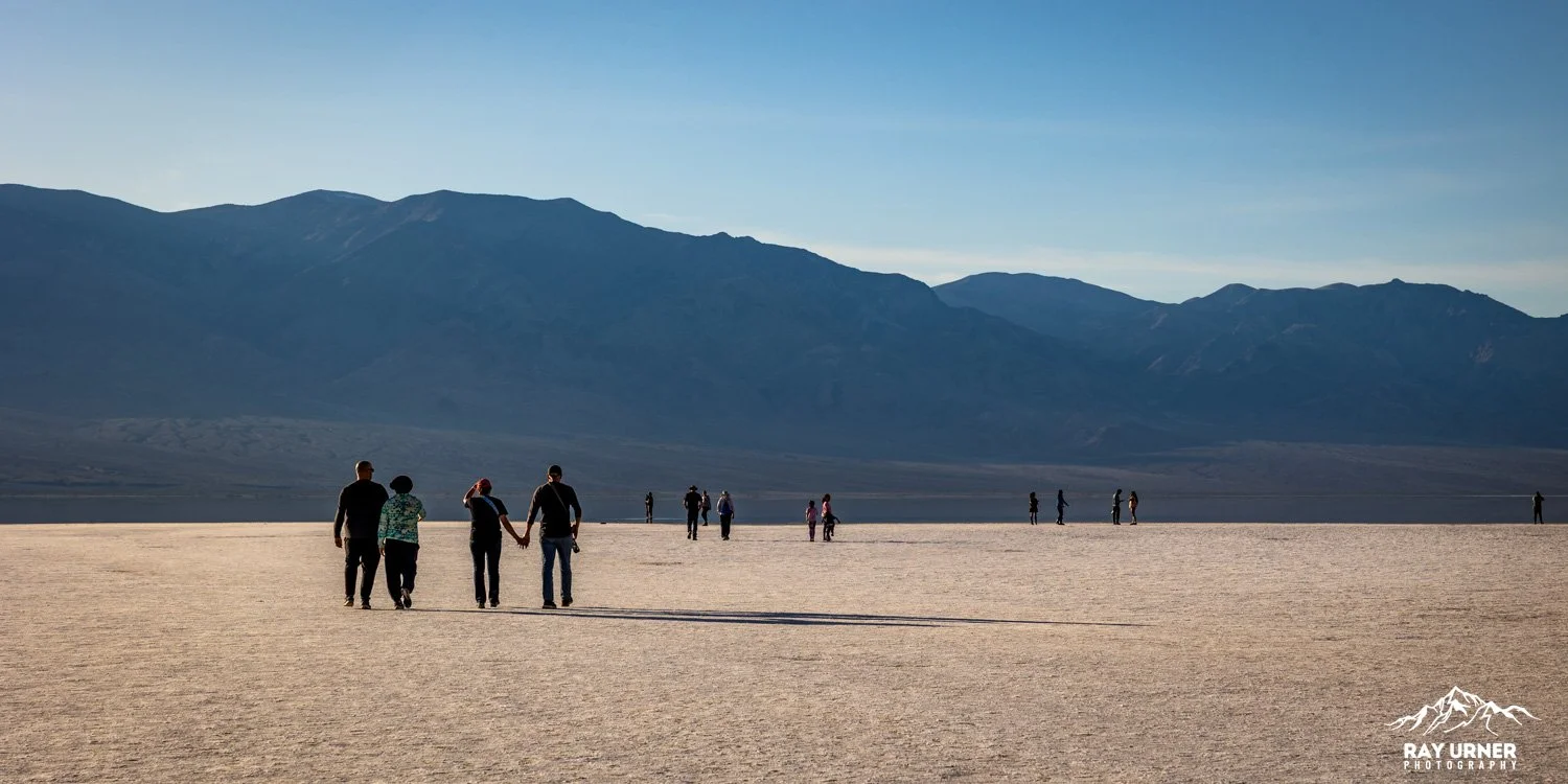
Badwater Basin
Badwater Basin is the lowest point in North America, sitting at 282 ft (86m) below sea level.
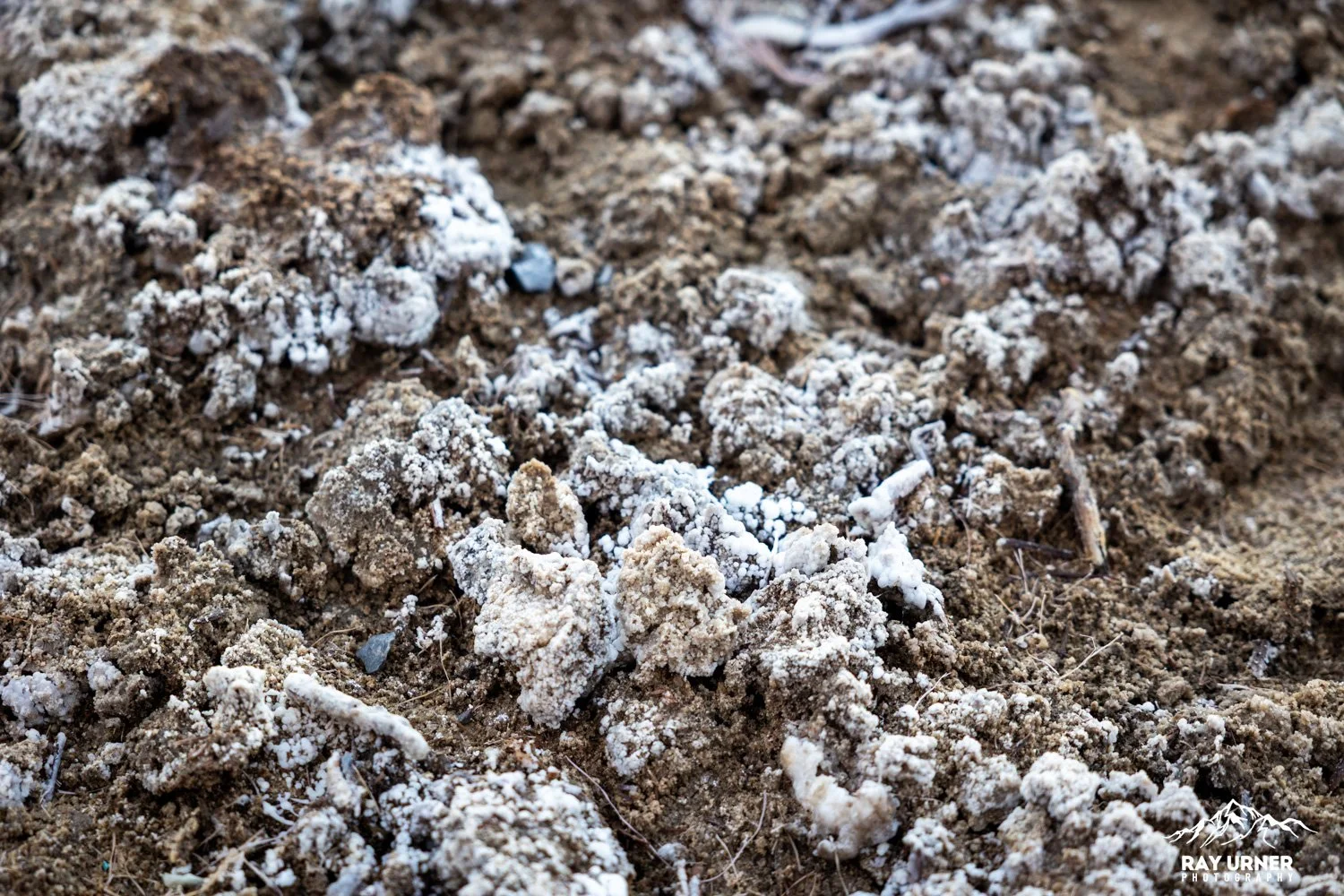
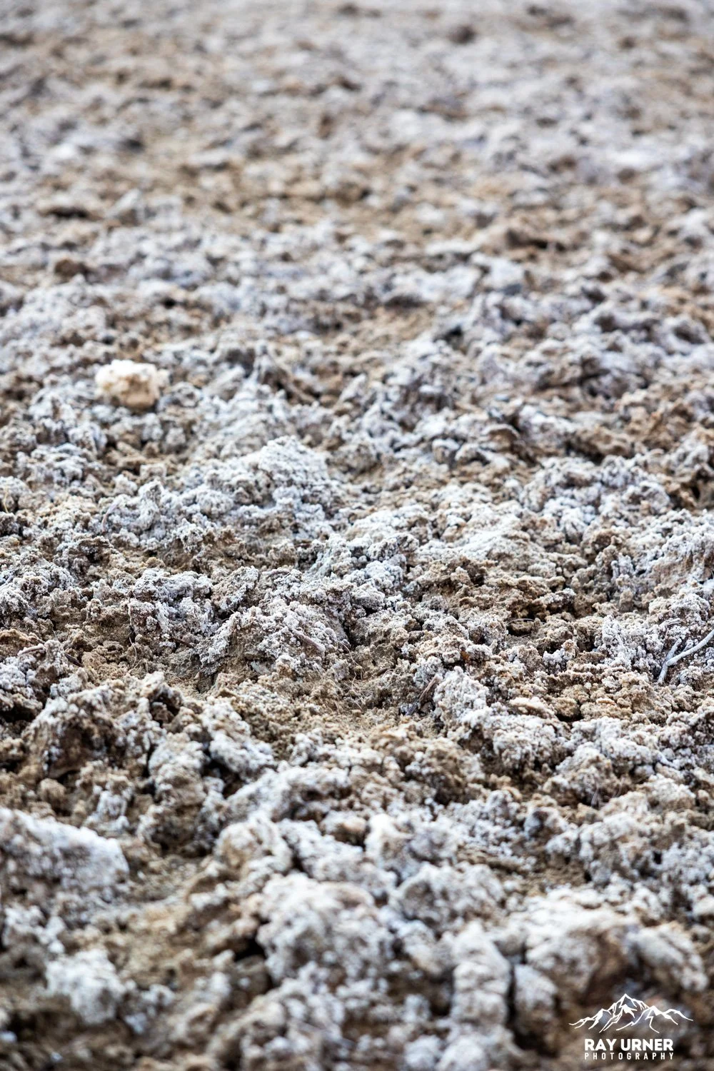
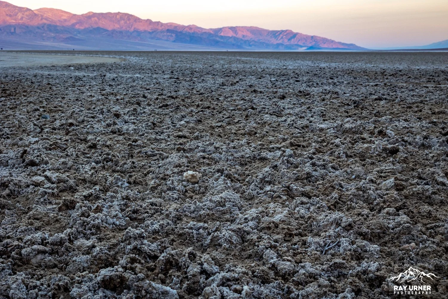
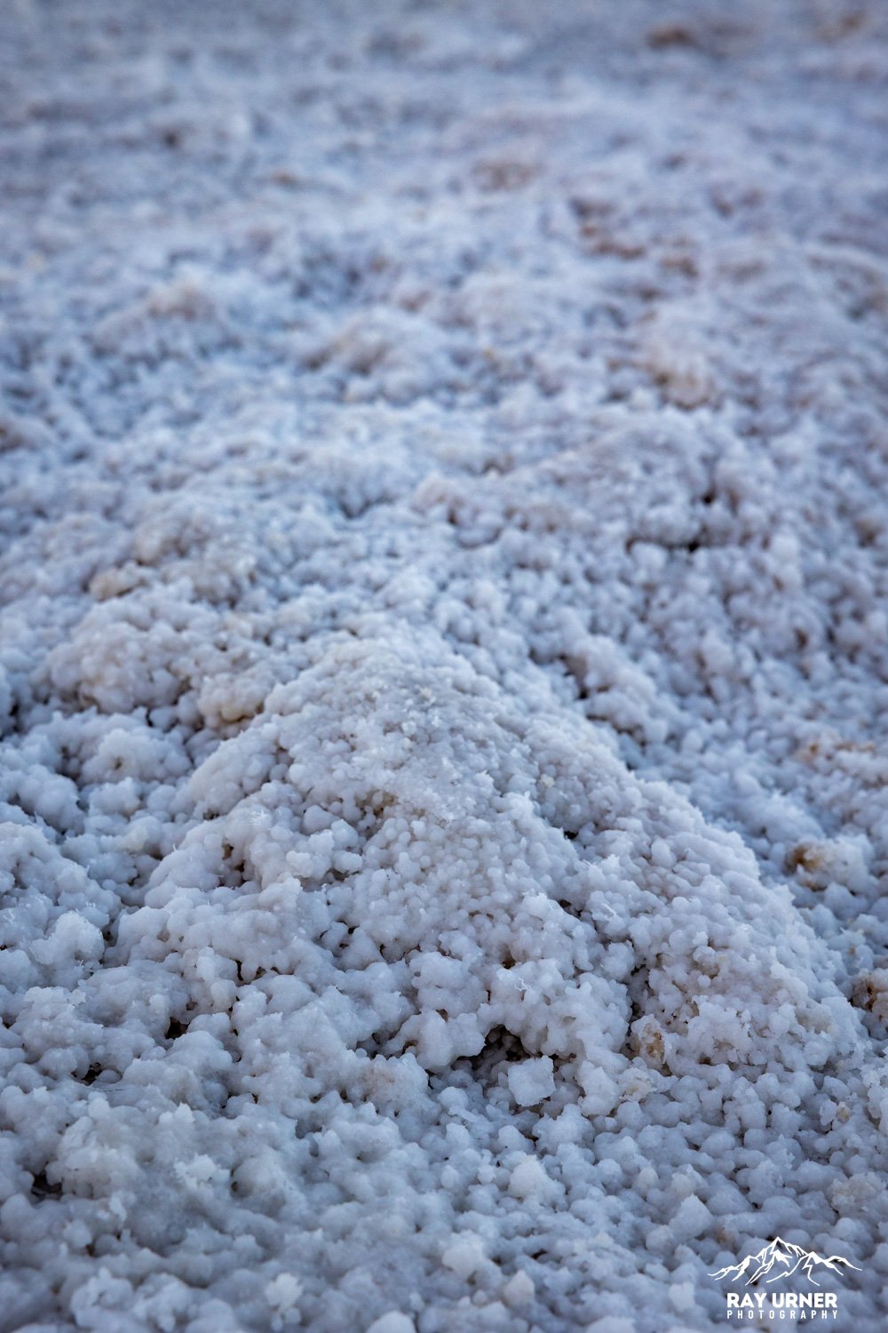
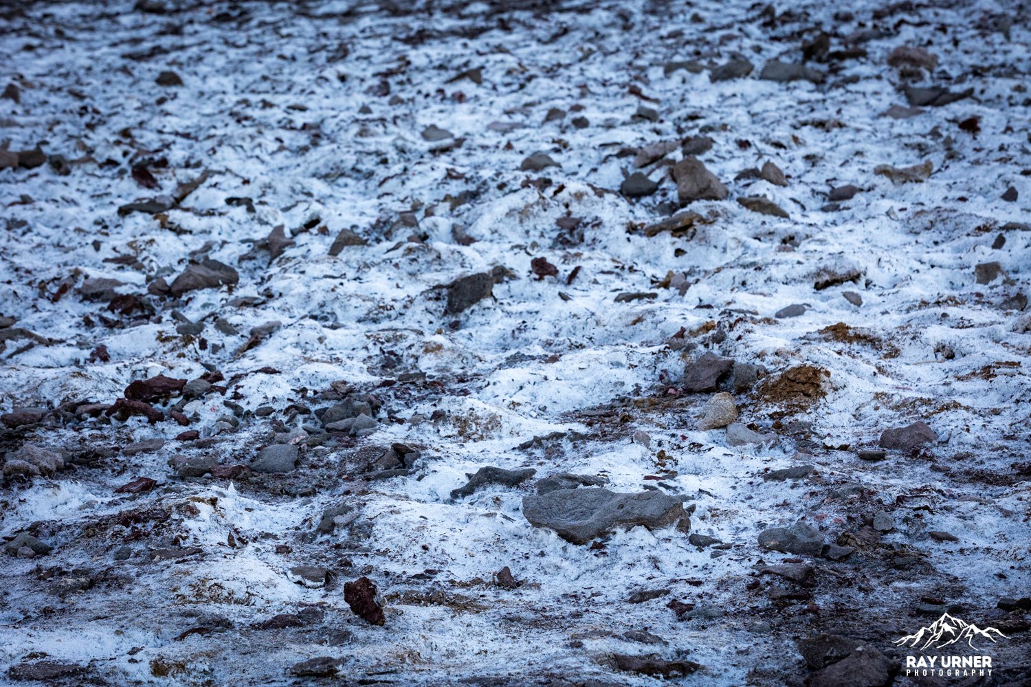
Its vast salt flats stretch for nearly 200 square miles, producing geometric polygon patterns created by evaporation cycles.
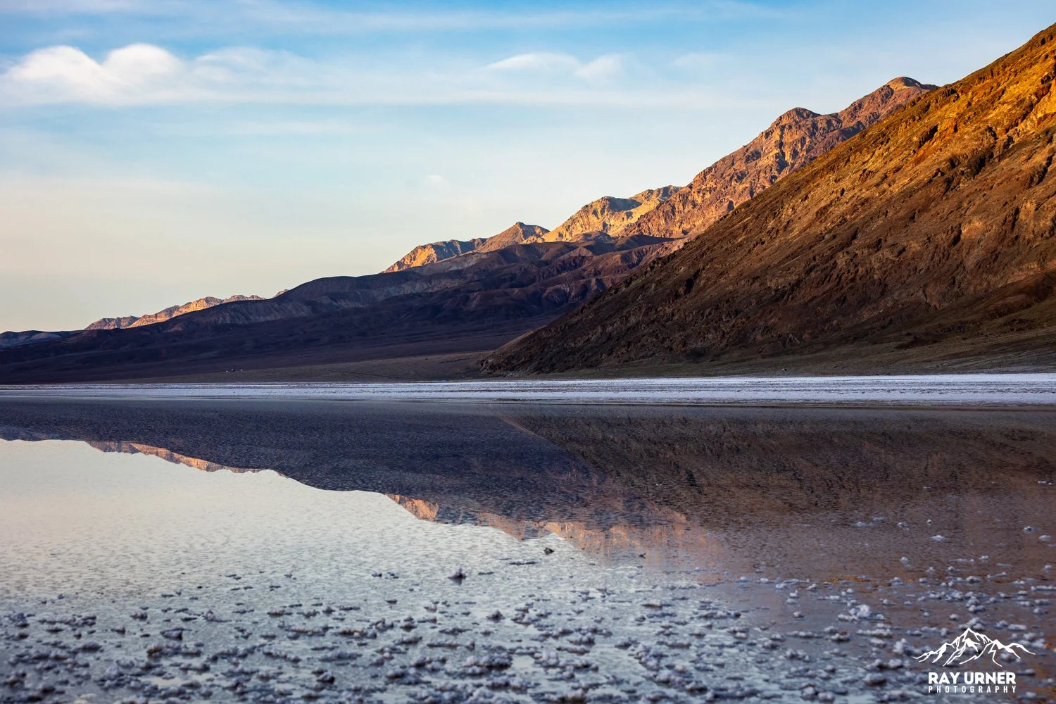
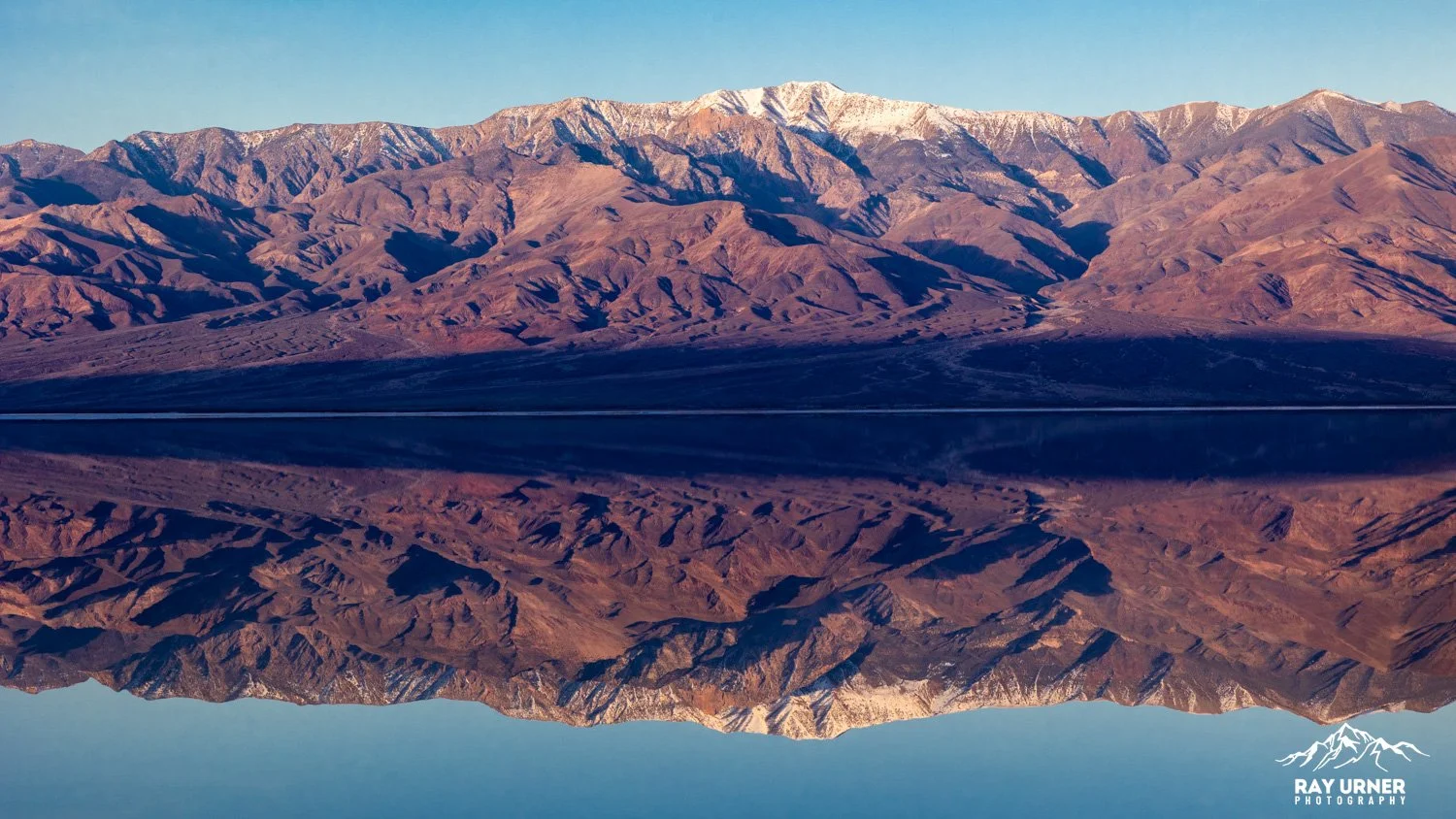
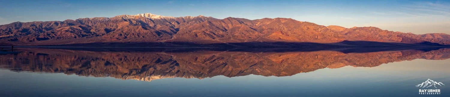
After large rain events, the basin can temporarily flood, forming the rare Lake Manly, an ephemeral mirror‑calm lake that transforms the salt flats into one of the most surreal reflective surfaces in the American Southwest.
Badwater Basin is a must‑visit for photographers — not just for its unique geology but for how dramatically it changes with light, moisture, and season.
Overview
Quick Facts
Elevation: −282 ft (−86 m), lowest point in North America
Location: Badwater Road, 30 minutes south of Furnace Creek
Walk to Salt Polygons: 1.5–2 miles RT for the best formations
Amenities: Paved parking lot, vault toilets; ADA ramp to boardwalk
Trail Type: Boardwalk → open salt flats (no marked trail)
Hazards: Extreme heat; avoid visiting after 10 a.m. in summer (NPS warning)
Pets: Not allowed on the salt flats
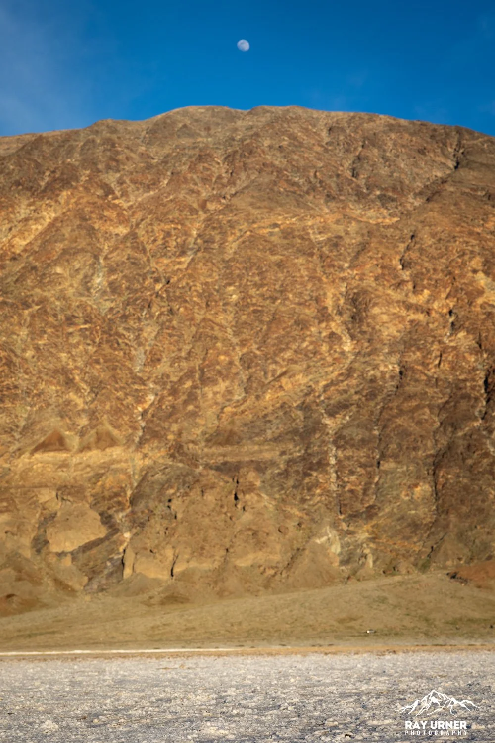
Geology & How the Salt Polygons Form
The basin is the evaporated remnant of ancient Lake Manly, a large inland lake that dried up thousands of years ago.
As groundwater rises through the salt crust and evaporates, repeated freeze–thaw cycles and evaporation push the surface into hexagonal salt polygons.
Each rain event dissolves and re‑crystallizes salt, resetting patterns and sometimes creating fresh, sharp-edged polygons, which are great for photography.
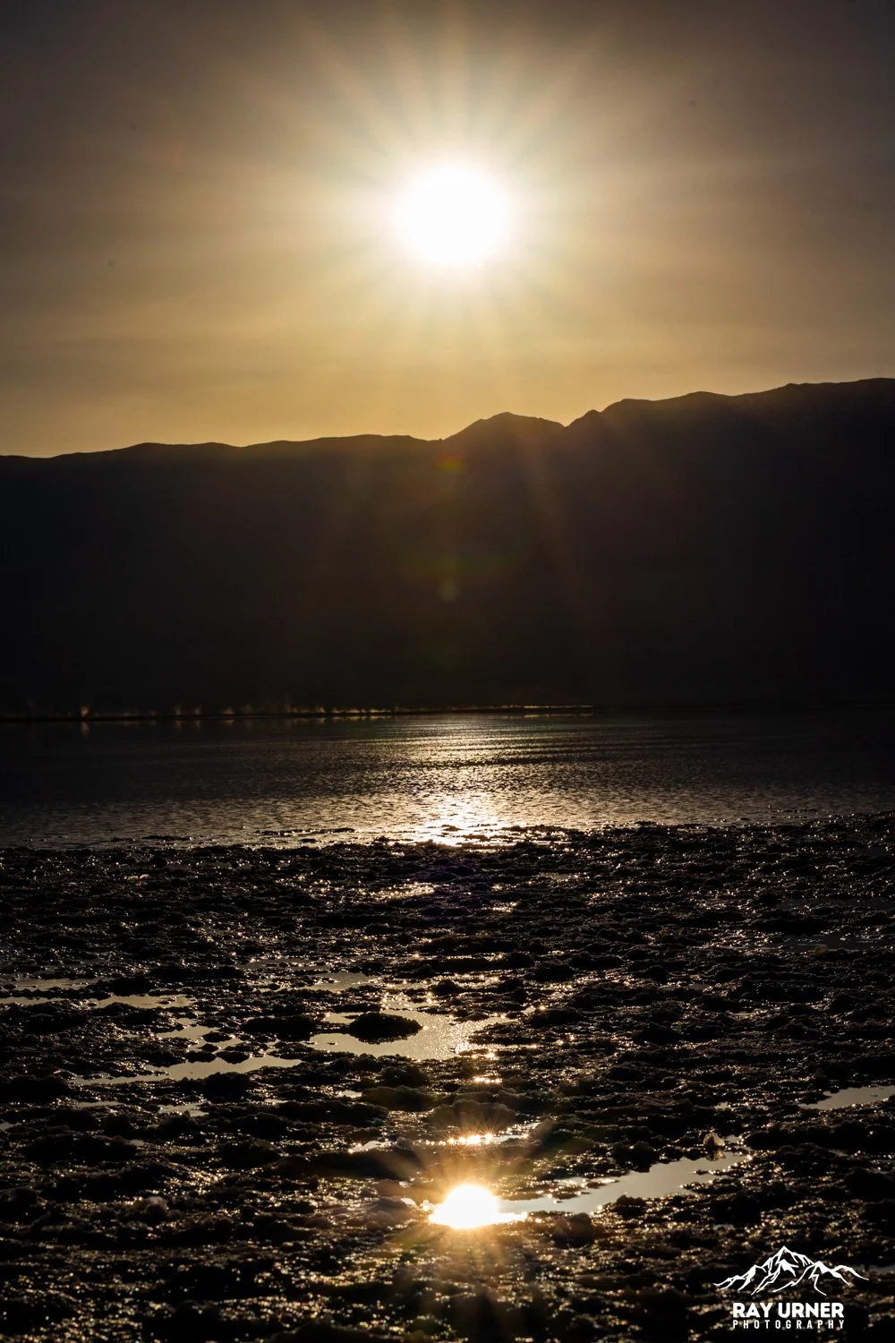
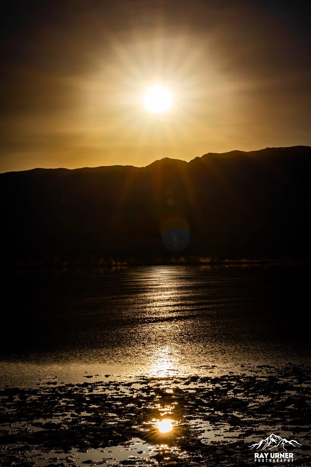
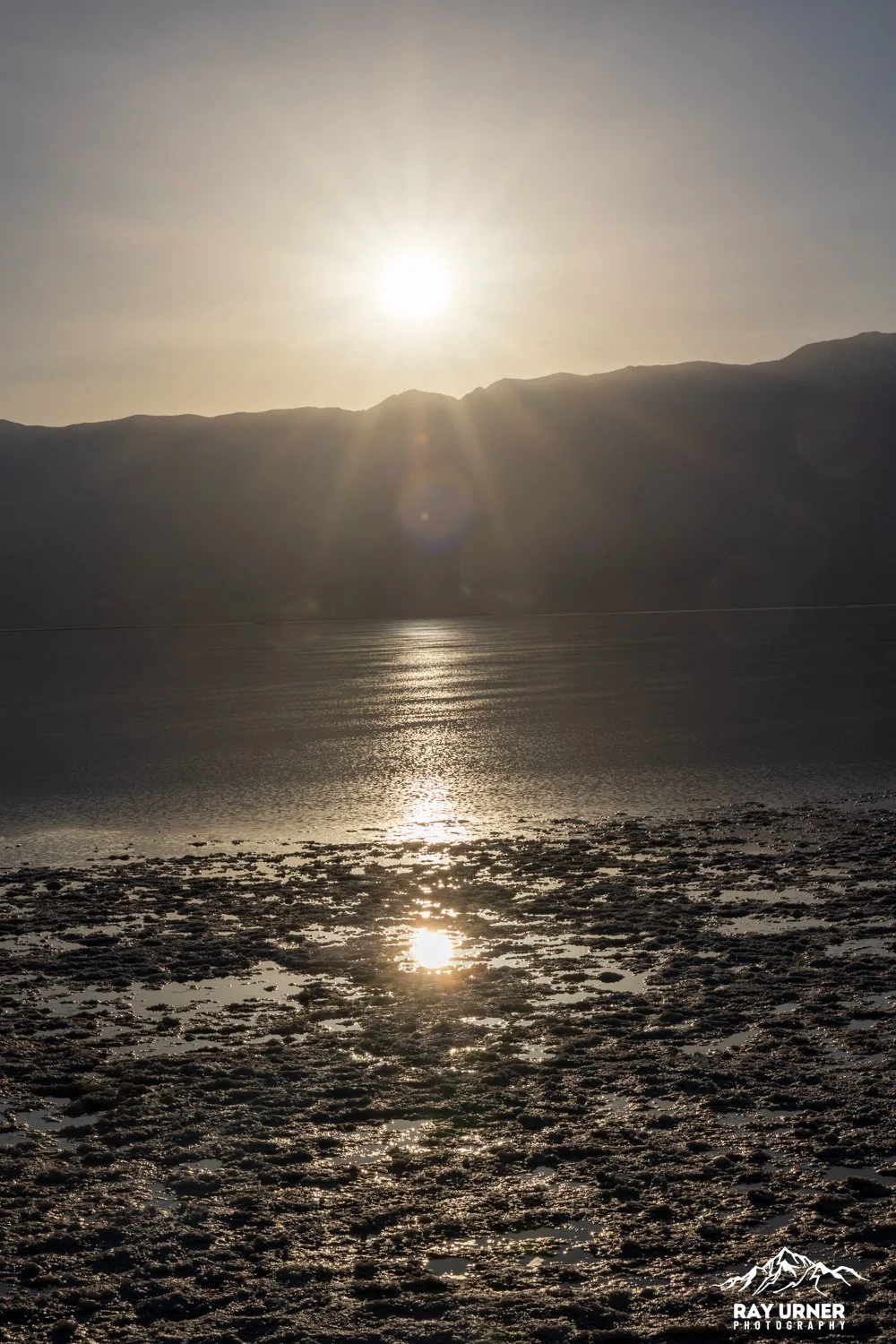
Photography Guide — Sunrise
Sunrise is arguably the best time to photograph Badwater Basin’s salt polygons.
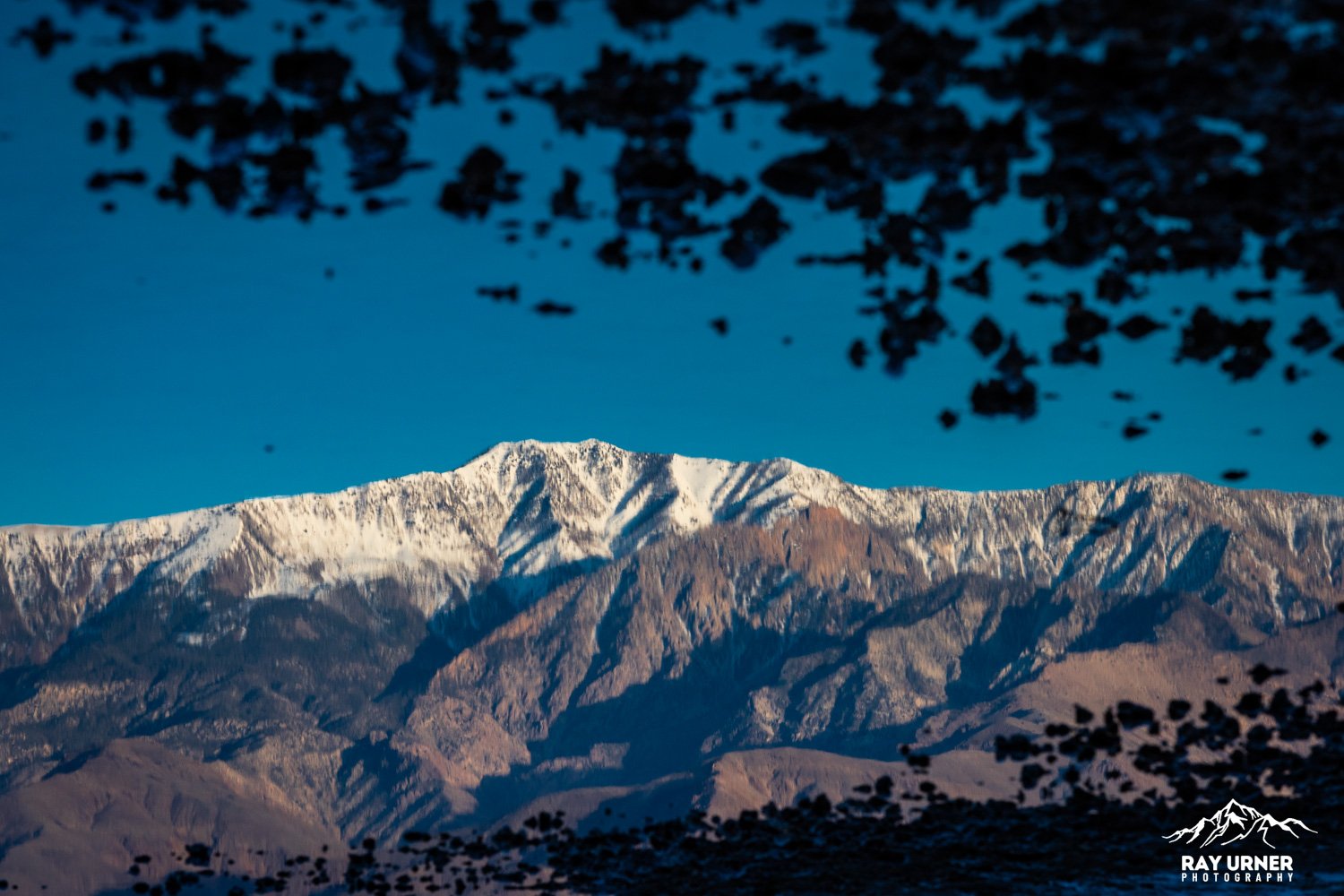
The Panamint Range to the west ignites with warm alpenglow, creating color contrast across the white salt.
The low‑angle sun creates long shadows inside polygon ridges, revealing shape and texture.
Sunrise Tips
1. Walk 20–30 minutes onto the flats
The polygons near the parking lot are heavily trampled and often destroyed by foot traffic. You must walk 1–1.5 miles for pristine formations.
2. Work the light from low angles
Place the sun behind ridges to accentuate shadow depth.
Use 16–35mm for sweeping pattern‑filled foregrounds.
3. Watch for pre‑dawn gradients
Sky reflections on salt crystals are subtle pastels — ideal for minimalist images.
4. Use the “Sea Level” sign for scale
The sign high on the Black Mountains is visible from the flats.


Photography Guide — Sunset
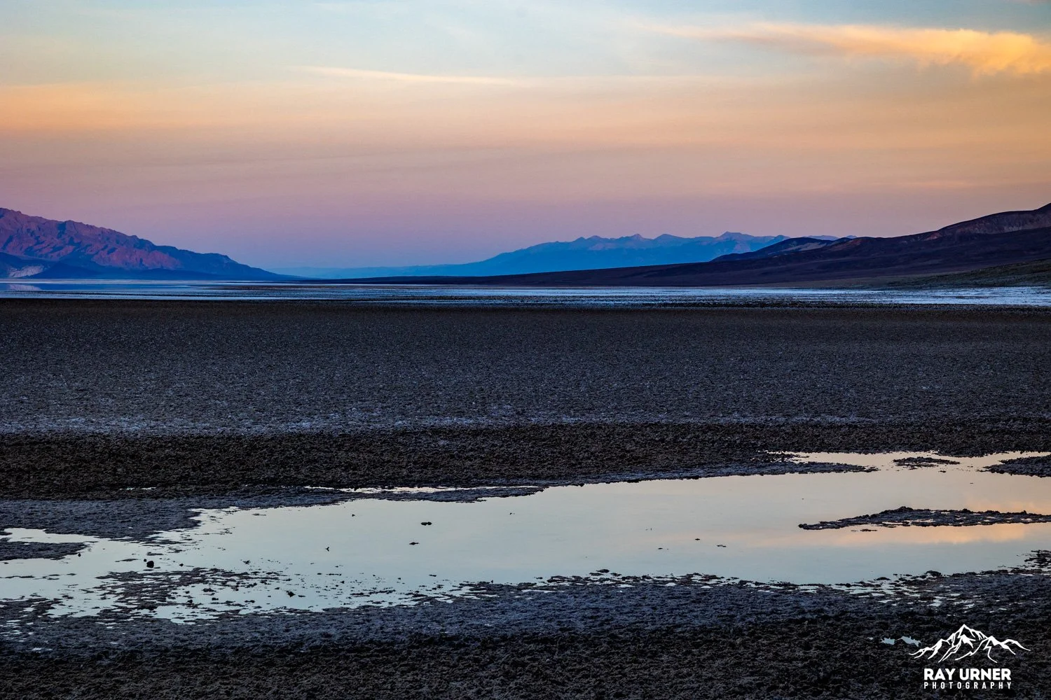
Sunset at Badwater Basin is warmer, more dramatic, and often more colorful than sunrise.
The sun sets behind the Panamint Range, lighting the mountains orange, red, and purple.
After the sun drops, reflected color bounces back onto the flats.
Sunset Tips
1. Shoot toward the Panamint Range
For maximum color in the scene, compose westward. This is when mountains pick up alpenglow.
2. Use telephoto (70–200mm)
Compressing ridges against lit mountains gives powerful vertical relief (mountains are over 11,000 ft high above the basin).
3. Blue hour works beautifully
Salt polygons catch cool cyan tones, contrasting with warm mountain color from minutes earlier.
4. Be aware of footprints
Late in the day the basin is busiest; aim for undisturbed areas.
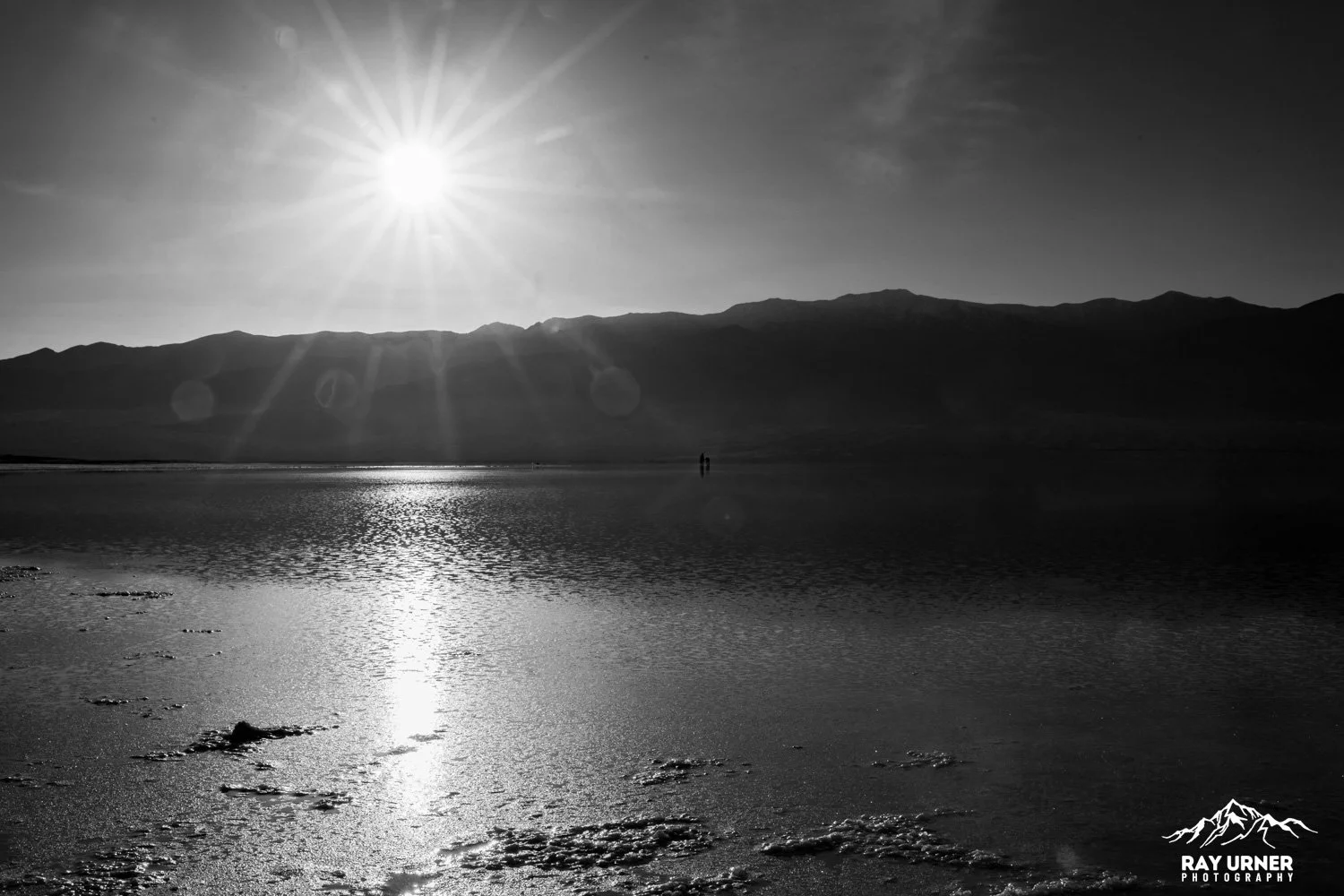
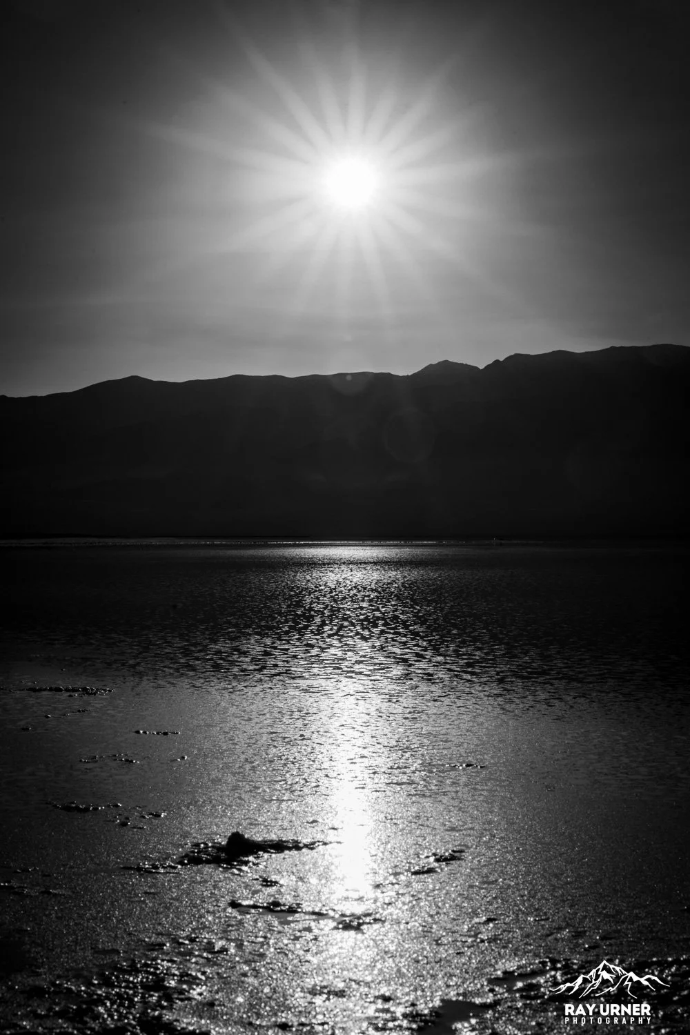


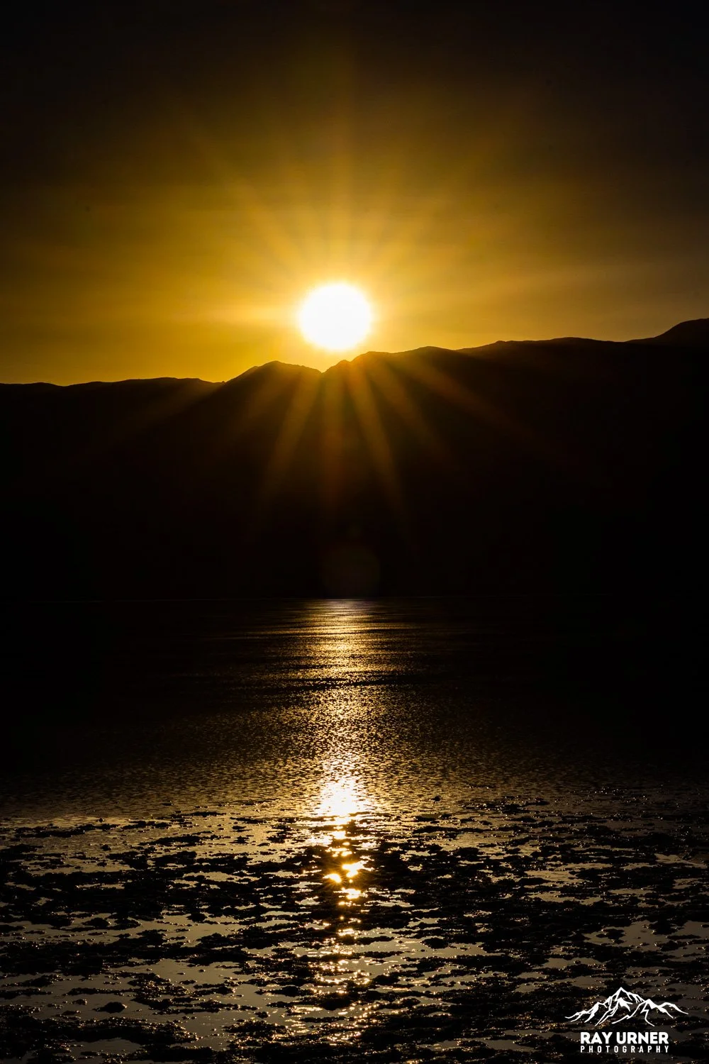
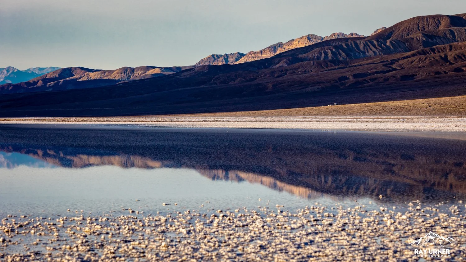
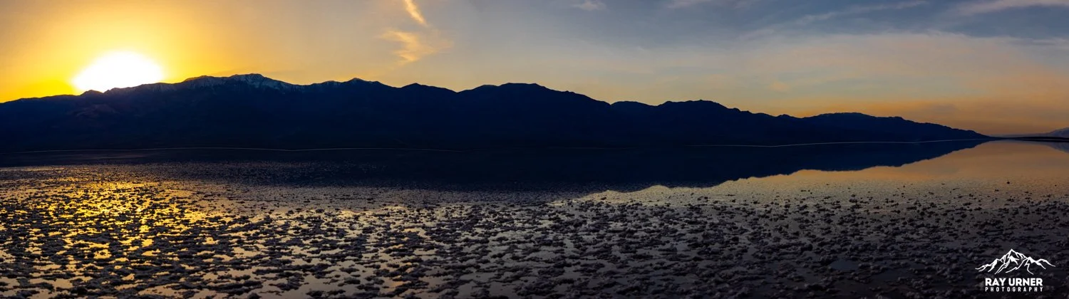
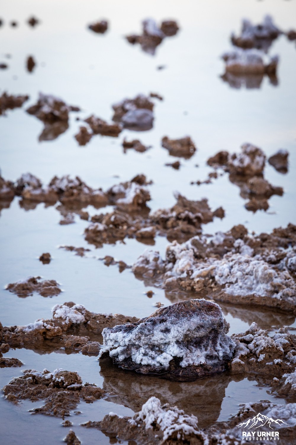
Lake Manly — What It Is
Lake Manly forms only after major rainfall, when stormwater temporarily fills the basin.
It is typically only a few inches deep and evaporates rapidly in Death Valley’s extreme climate.
Events in 2005, 2024, 2025, and 2026 produced significant lakes, attracting photographers from around the world.
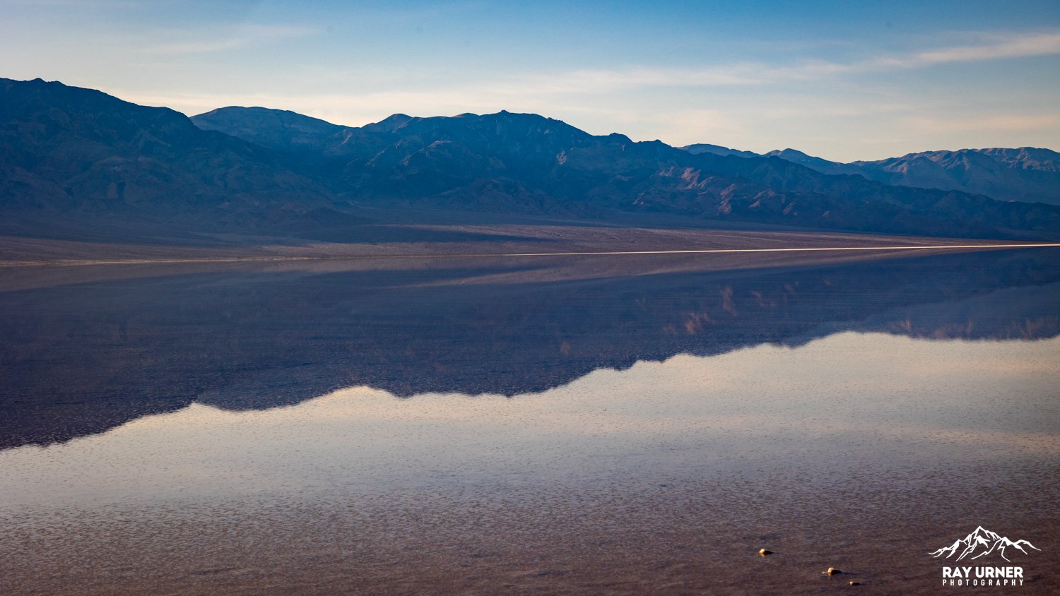
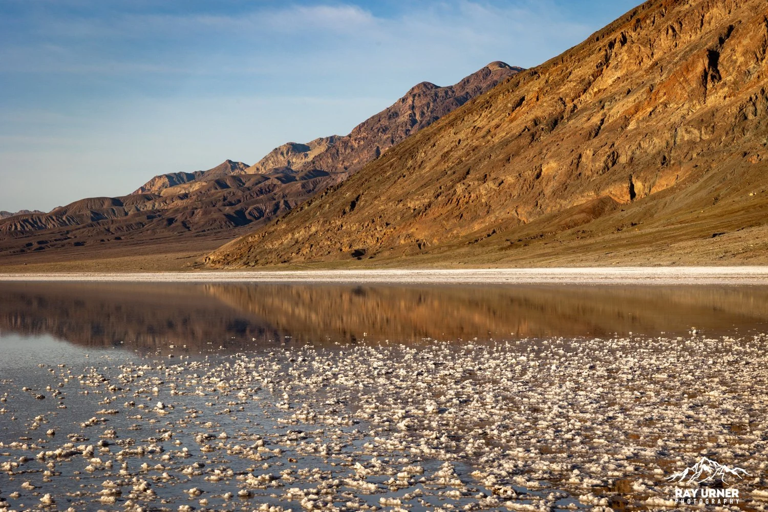
Photographing Lake Manly — Reflections
When calm, Lake Manly becomes a massive mirror reflecting the Panamint Range, clouds, and sky — some of the most surreal landscape reflections in North America.
Best Conditions
Windless sunrise = glassy mirror surface
Windy sunset = textured ripples with golden highlights
Clouds amplify color and shape
Composition Tips
1. Go ultra‑wide for “sky in sky” images
With water just inches deep, reflections look like upside‑down mountain ranges floating in blue sky.
2. Include salt crystals emerging from the water
Foreground fragments add scale and anchor the reflection.
3. Shoot vertical panoramas
Reflections often need tall framing to capture both mountains and mirror.
4. Avoid walking into wet areas
Footprints can take years to heal and will ruin your composition.
Where to Access Lake Manly Safely
Lake Manly usually forms a short walk from the Badwater Basin boardwalk, often 0.25–1 mile depending on water distribution. During recent floods, visitors walked directly from Badwater parking toward the water’s edge.
Always check NPS conditions before approaching, as restrictions change based on water levels and surface softness.
On‑the‑Ground Notes
Sun protection is crucial — the salt flats reflect UV intensely.
Footwear: The flat is sharp and uneven; avoid barefoot walking even in lake conditions.
Do not eat the salt — visitors (ok, tourons) have tried, and it’s extremely unsafe.
Bring water (no shade anywhere).
Pro Tips
For polygons: go early, walk deep, and carry a flashlight for predawn setup.
For Lake Manly: aim for calm mornings — evenings often have breeze.
For reflections: use a circular polarizer sparingly; too much polarization kills reflections.
For minimalism: focus on foreground crust and horizon lines to create bold compositions.