

Zabriskie Point
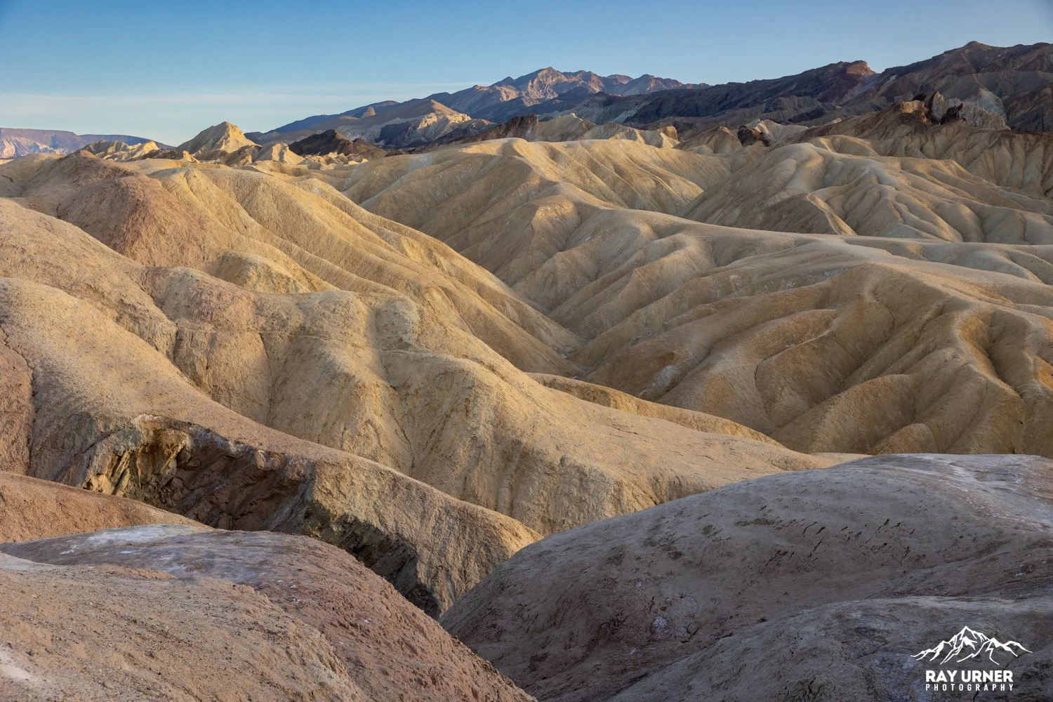
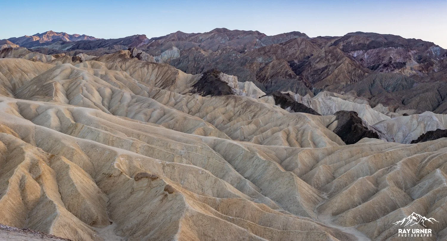
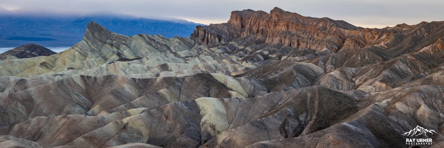
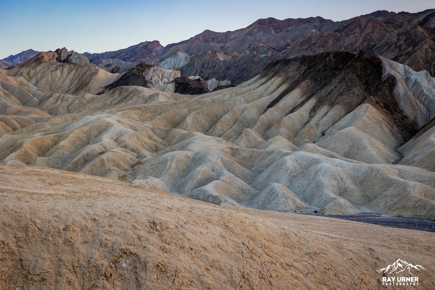
Zabriskie Point is one of Death Valley’s most iconic viewpoints — a sculpted landscape of golden mudstone ridges shaped by millions of years of erosion. It is located just east of Furnace Creek and is considered one of the park’s most photographed locations.
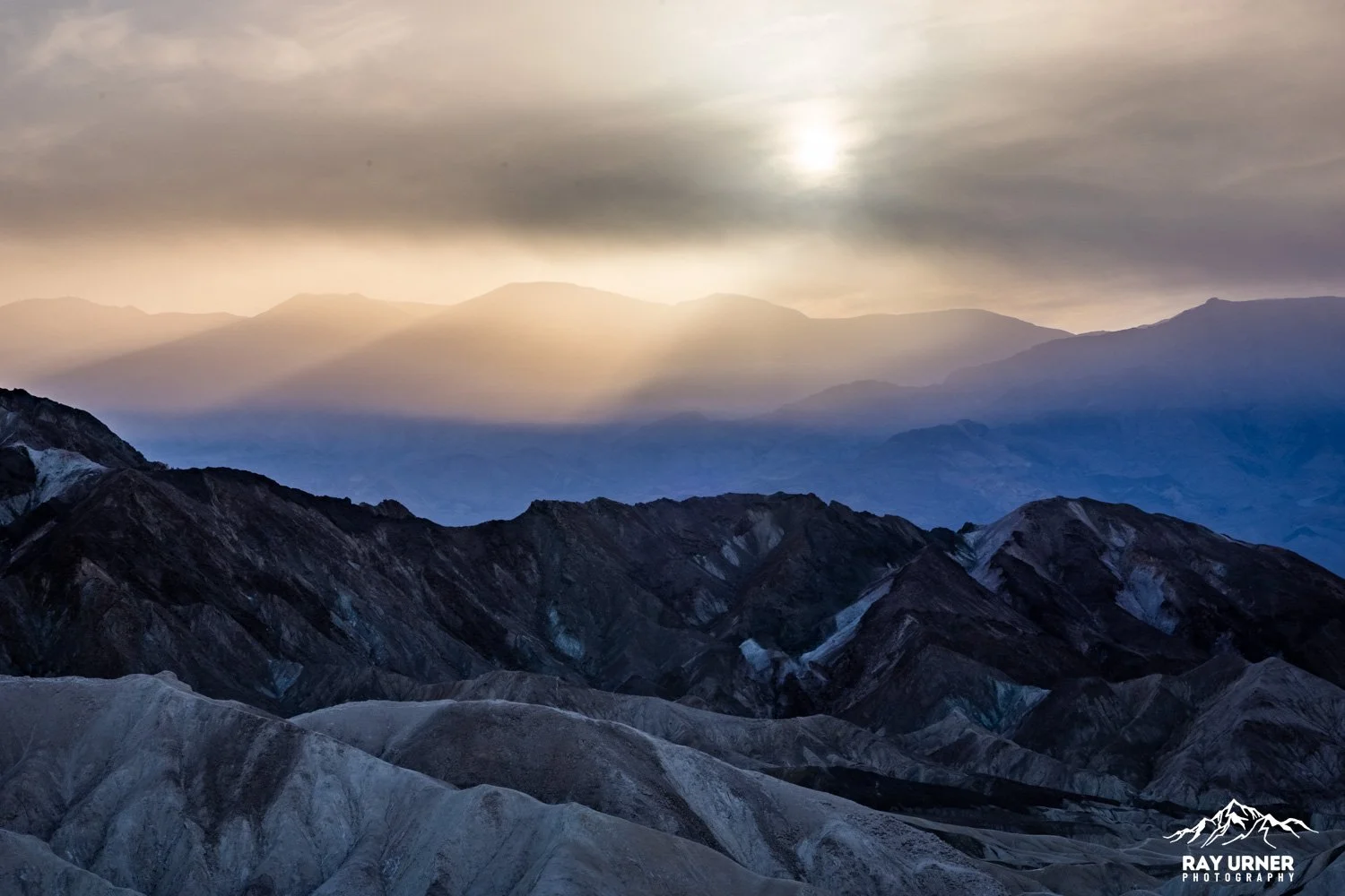
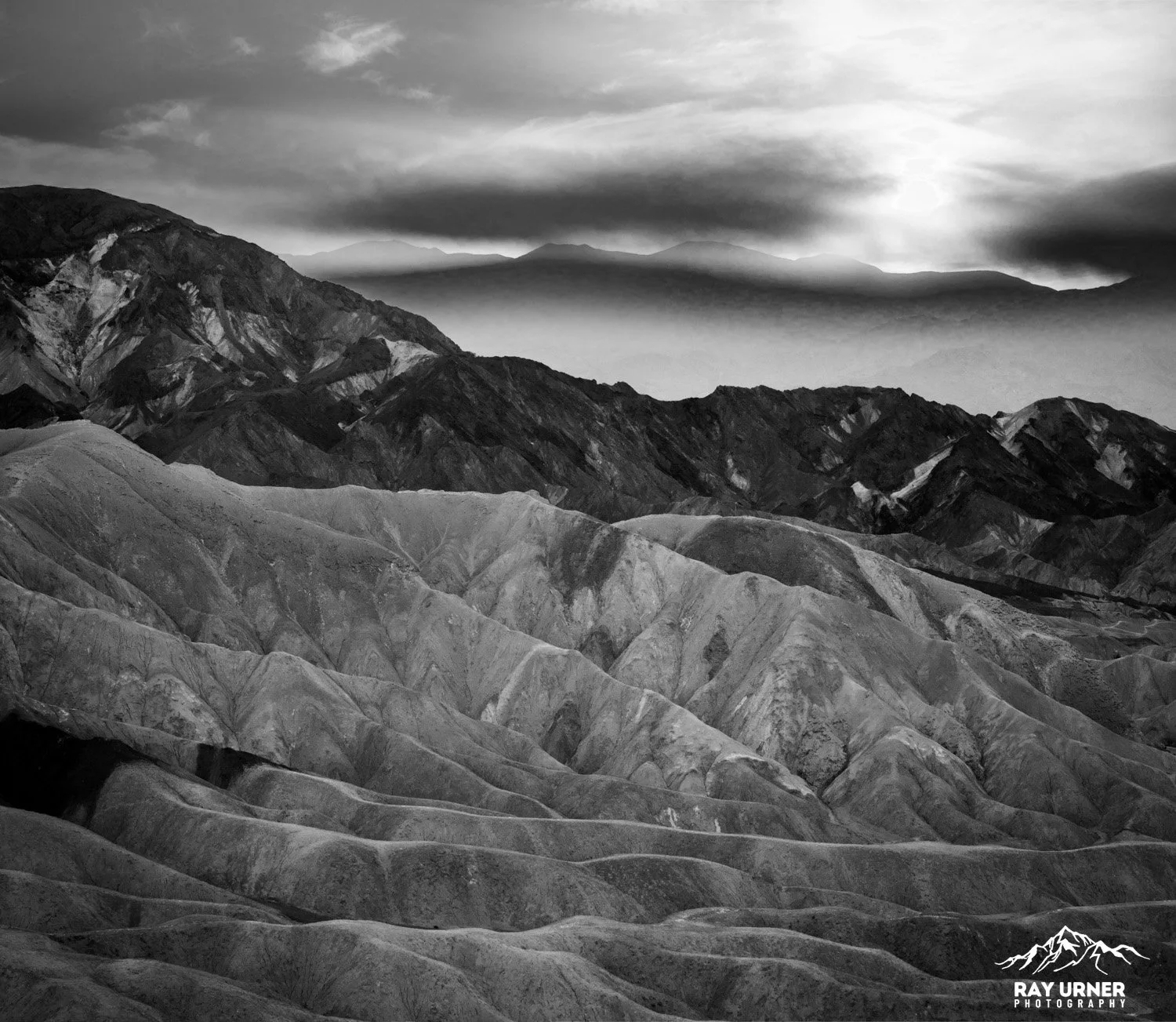
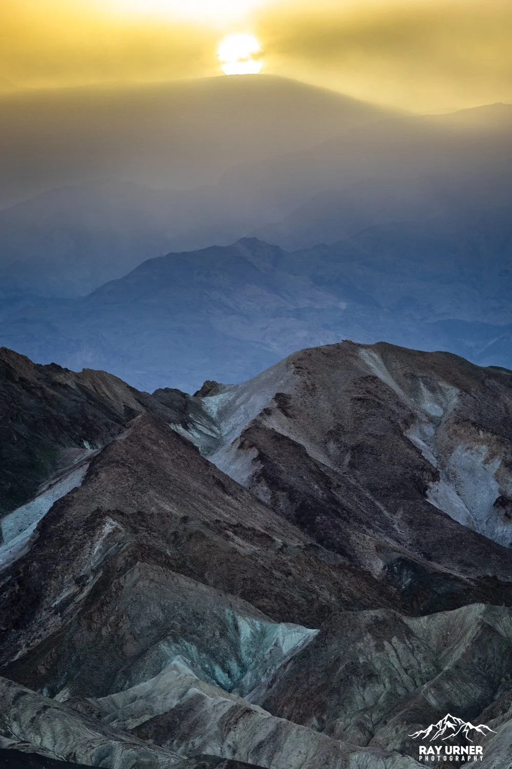
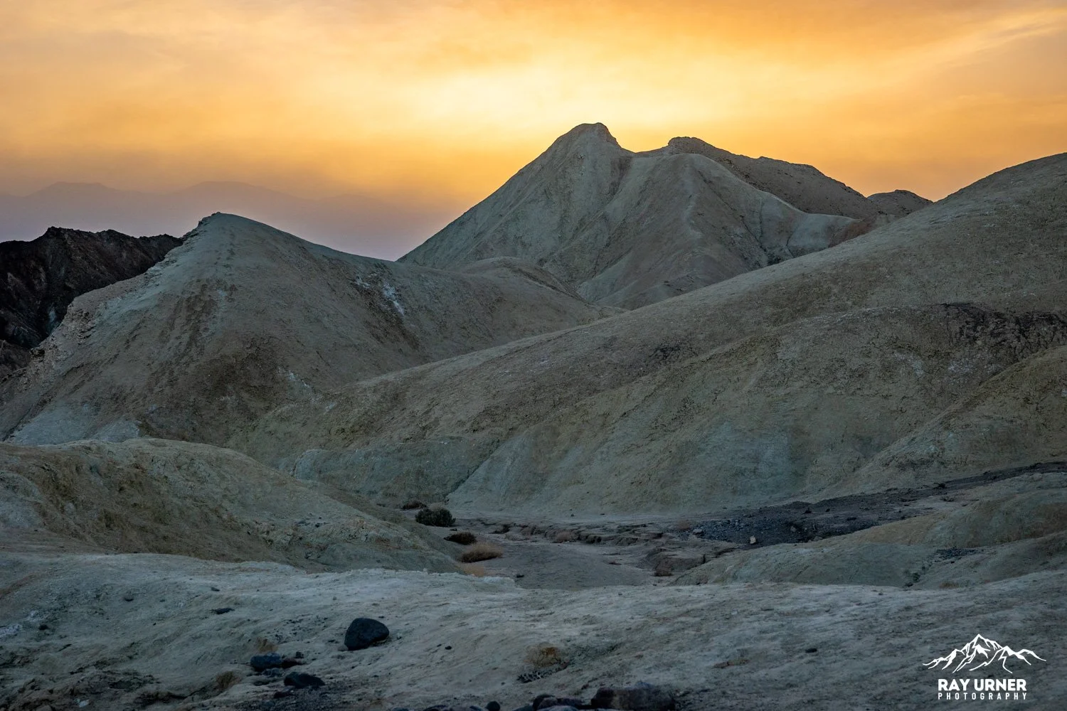
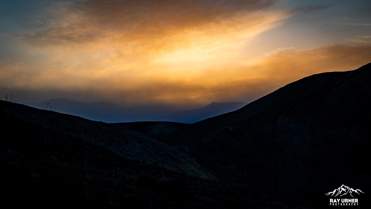
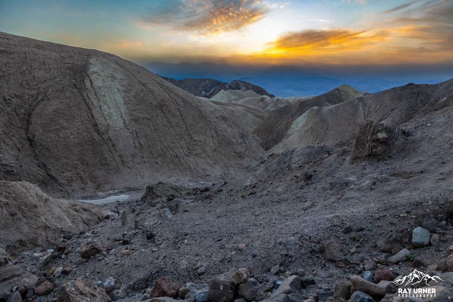
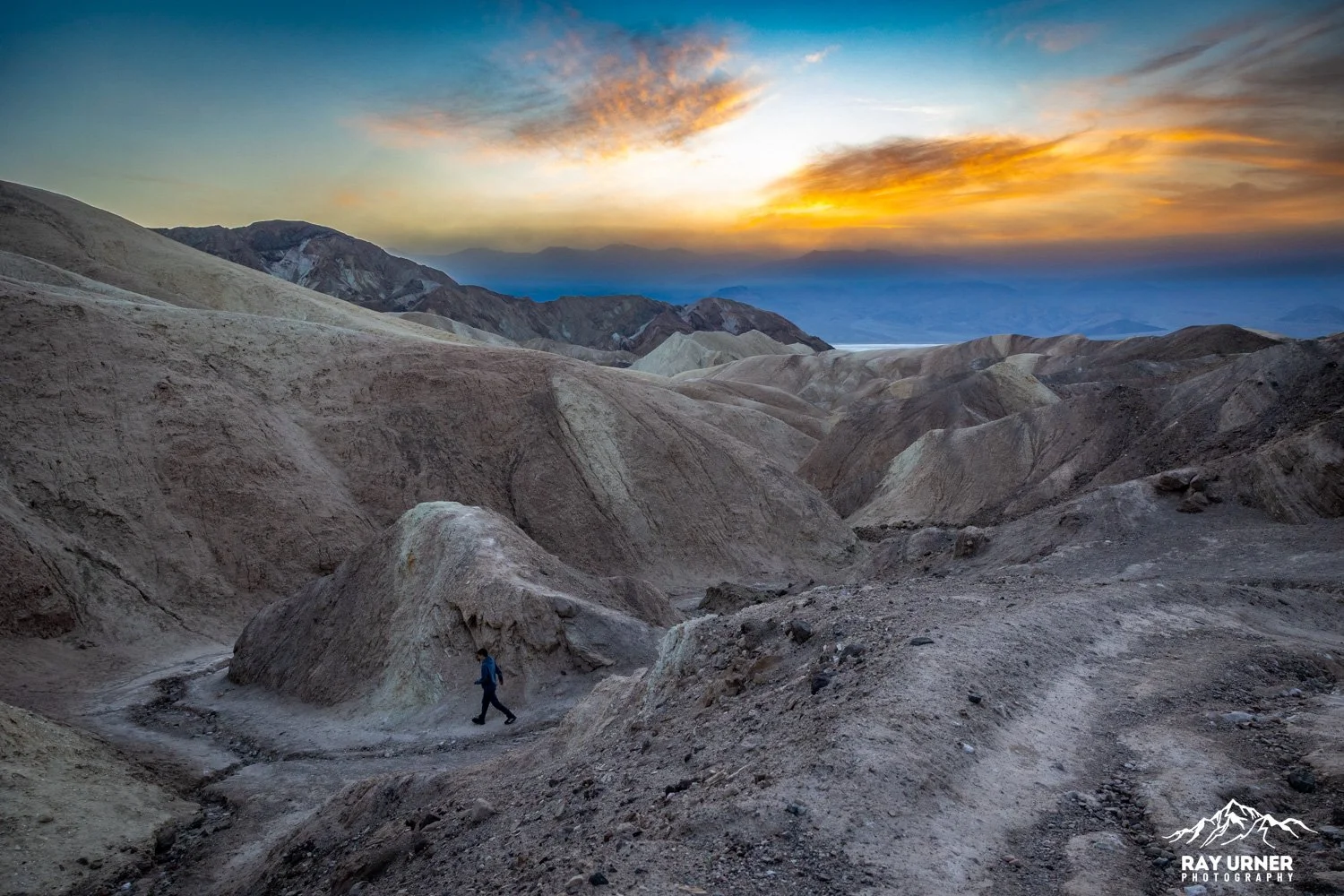
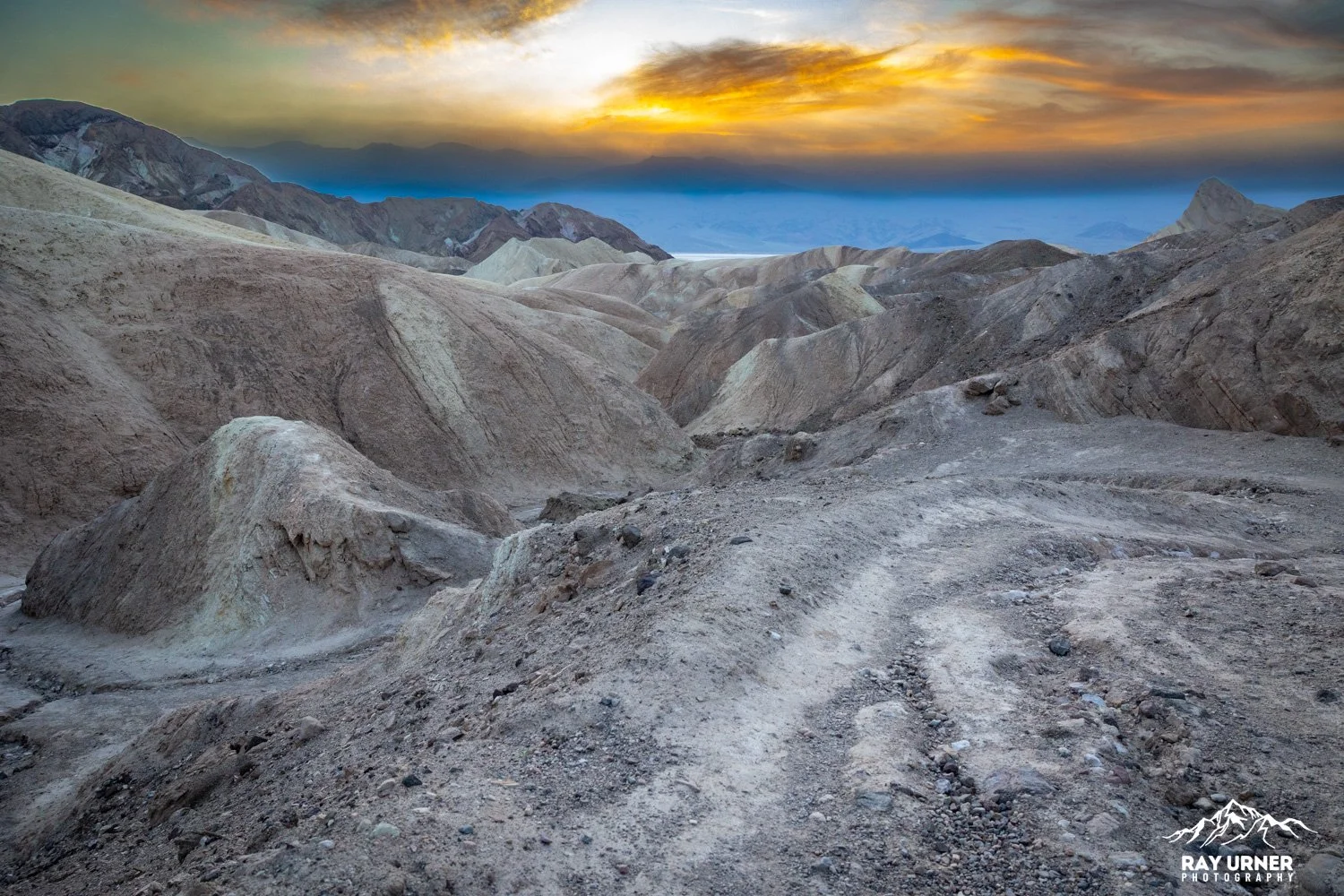
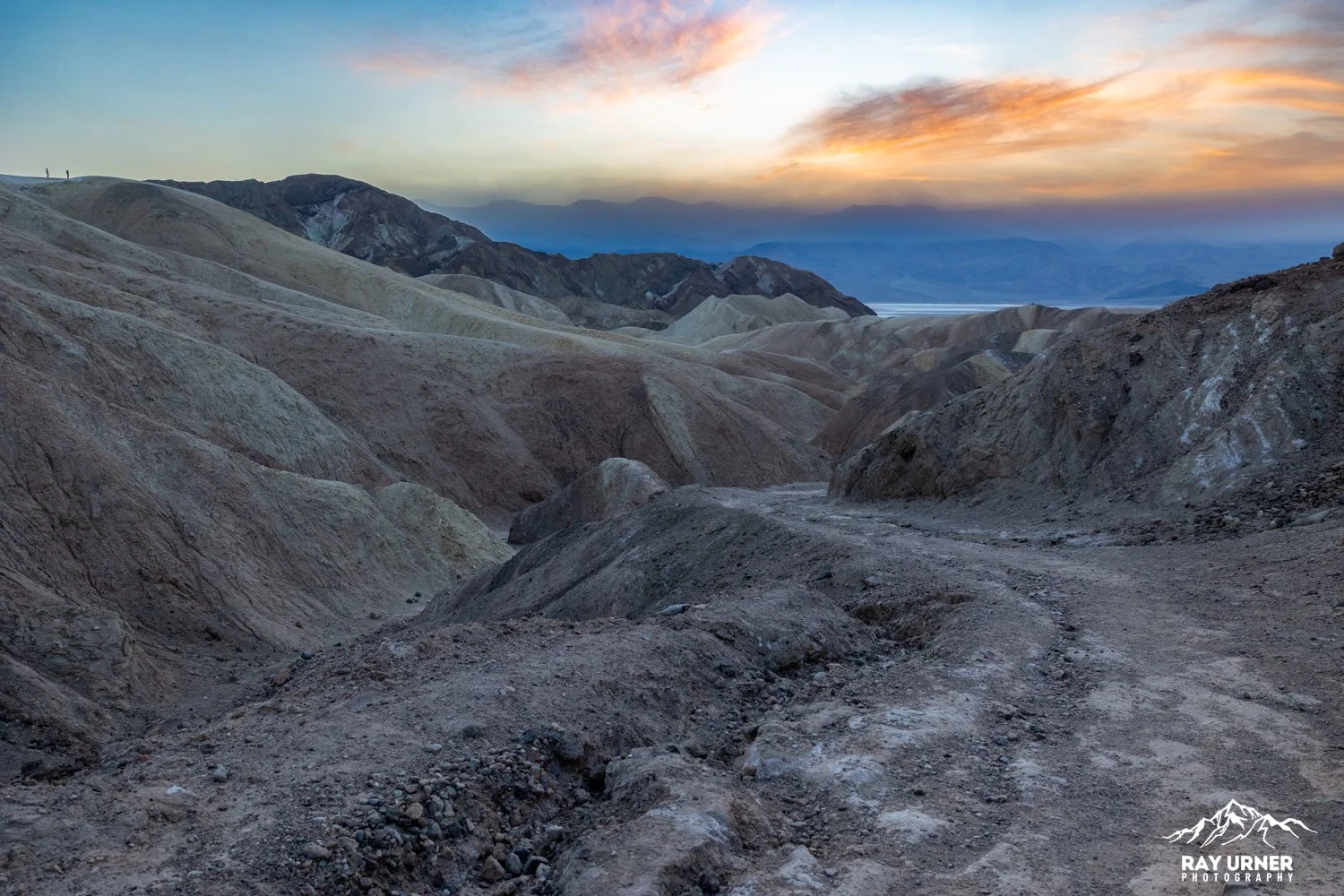
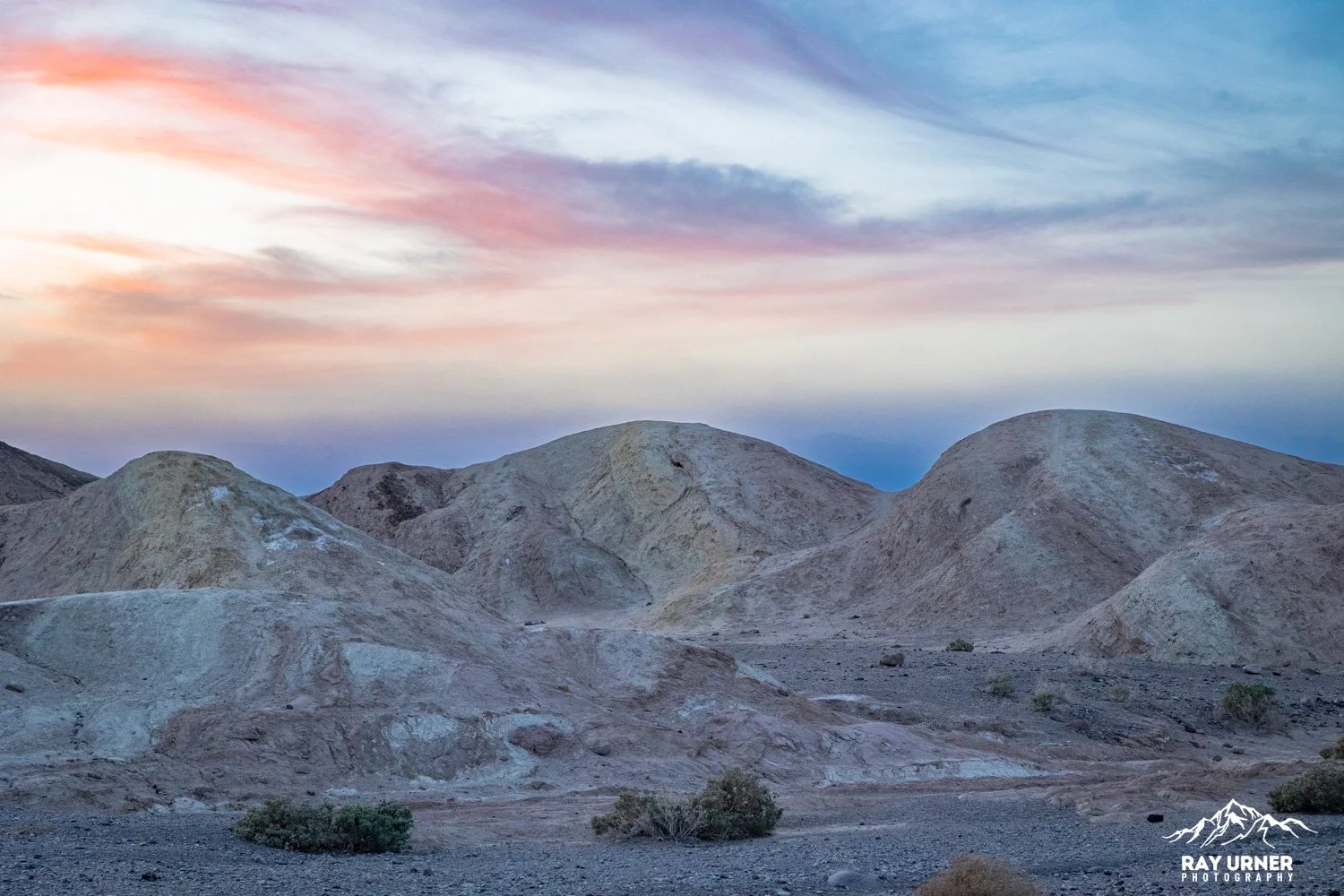
At sunset, the point glows with warm color from the Panamint Range, while the badlands below cast long shadows that reveal their intricate textures.
Overview
Quick Facts
Location: CA‑190, 3.5 miles east of Badwater Road
Parking: Paved lot with large spaces + vault toilet on‑site
Main Overlook Distance: ~0.2–0.3 miles uphill walk on a paved path (easy)
Badlands Loop: 2.7‑mile loop starting right from the viewpoint.
Golden Canyon/Gower Gulch Connections: Form a much longer route (up to 6–9 miles depending on loops) but can be sampled in short segments from Zabriskie.
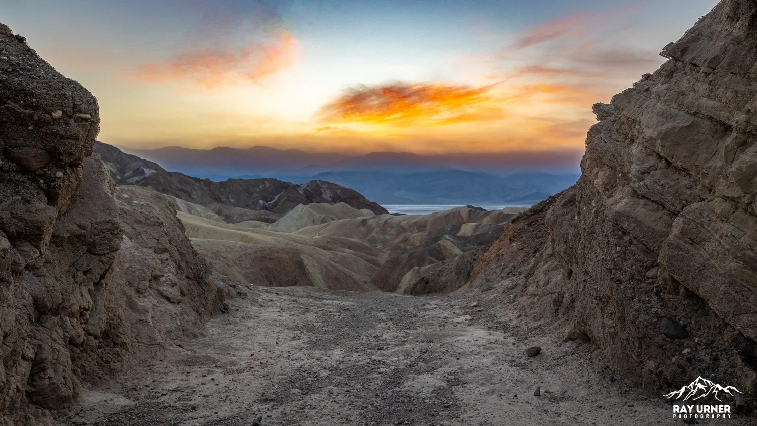
The Main Overlook (Sunset Details)
What You See
From the official lookout you’ll see:
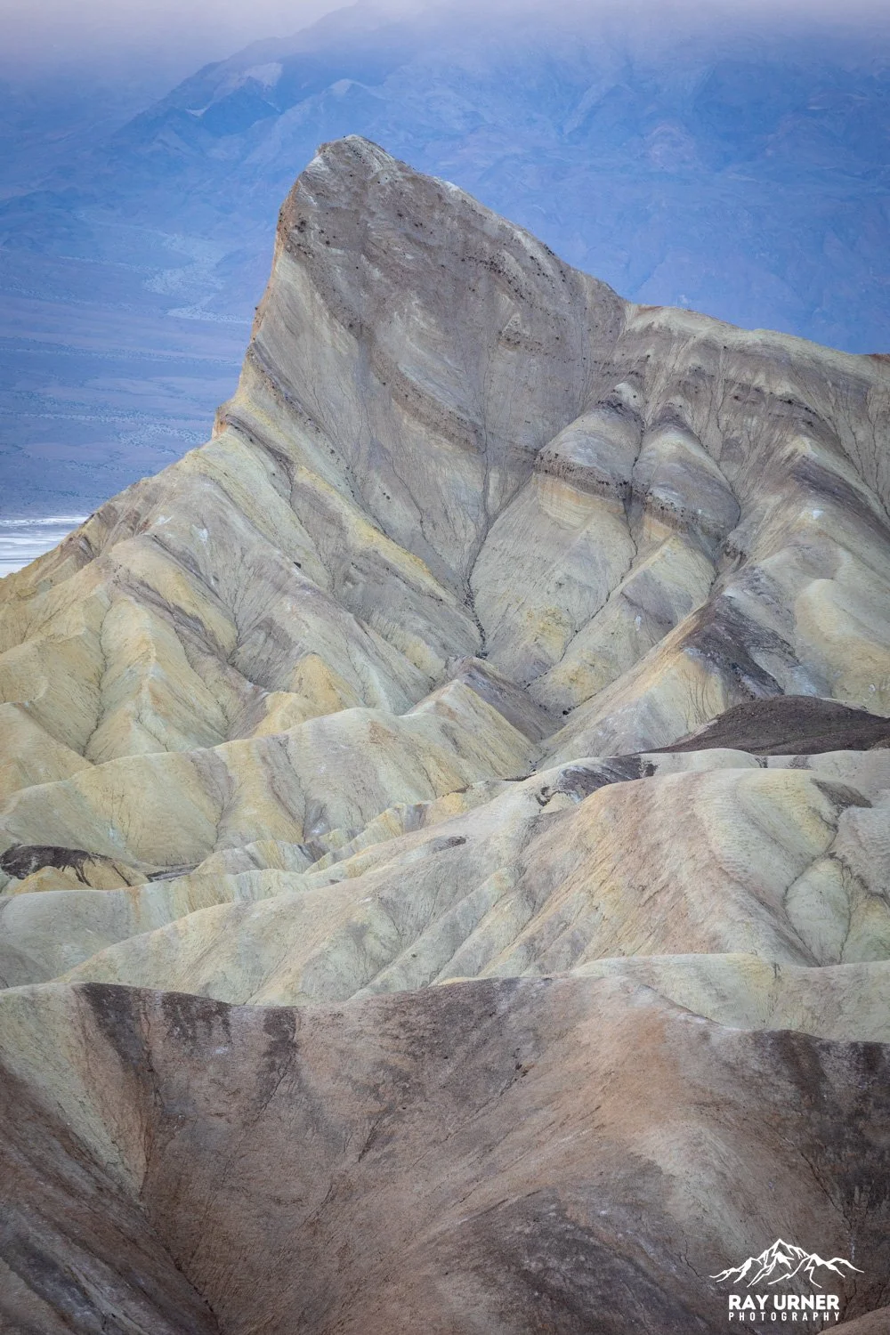
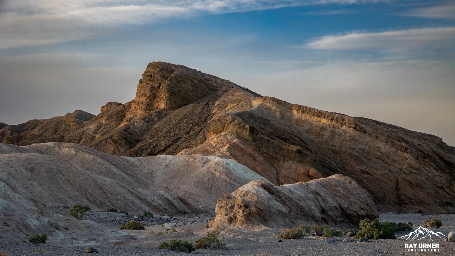
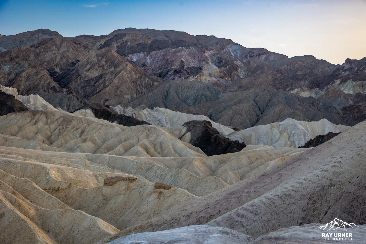
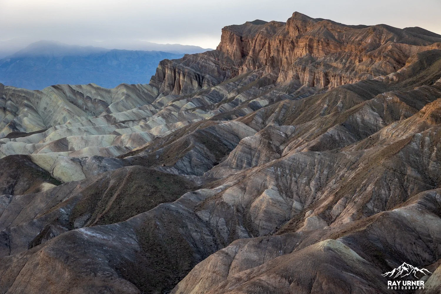
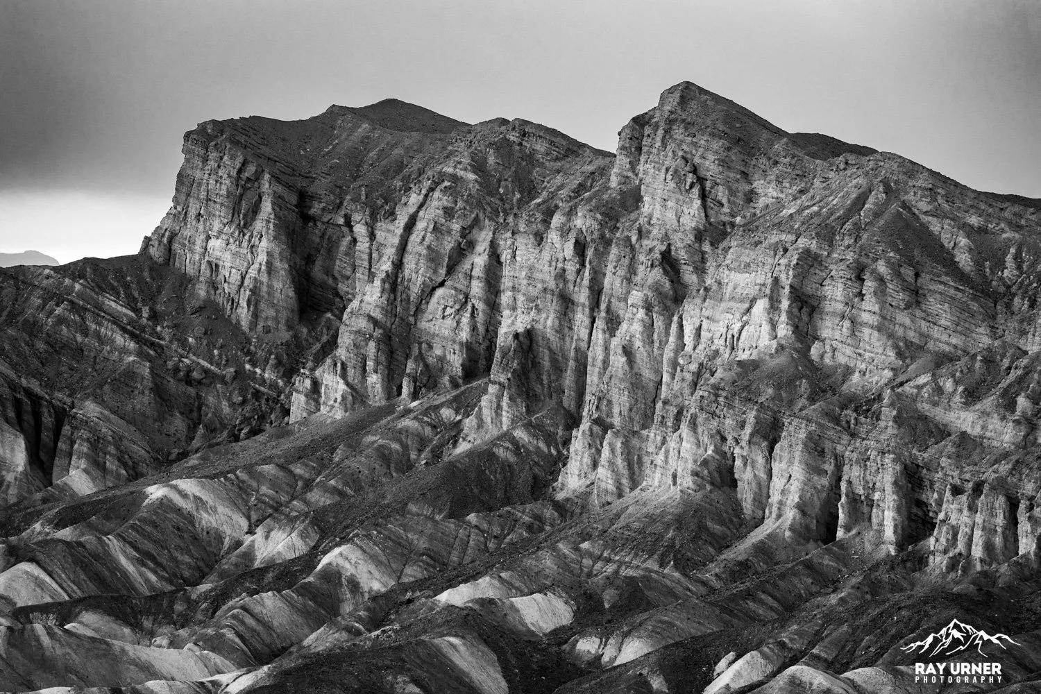
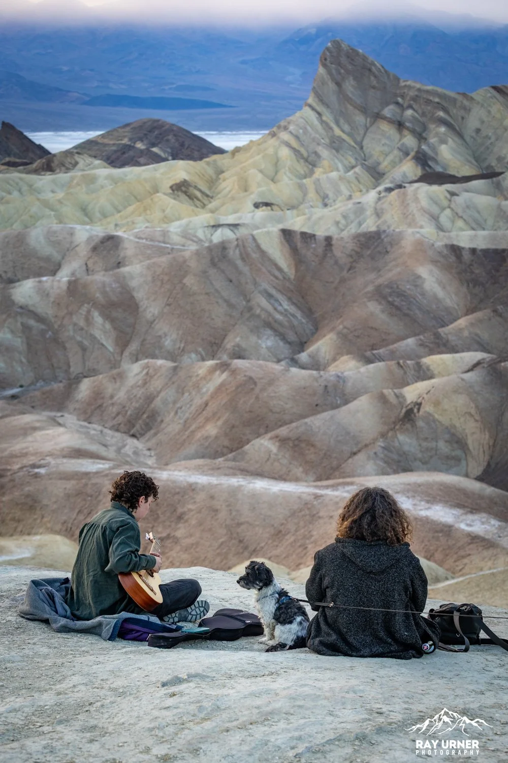
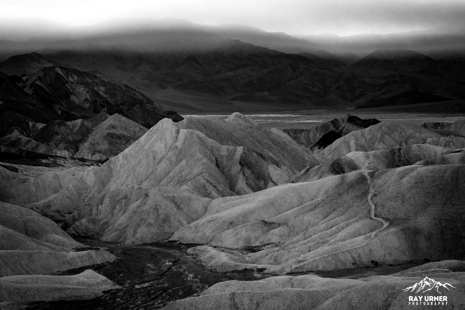
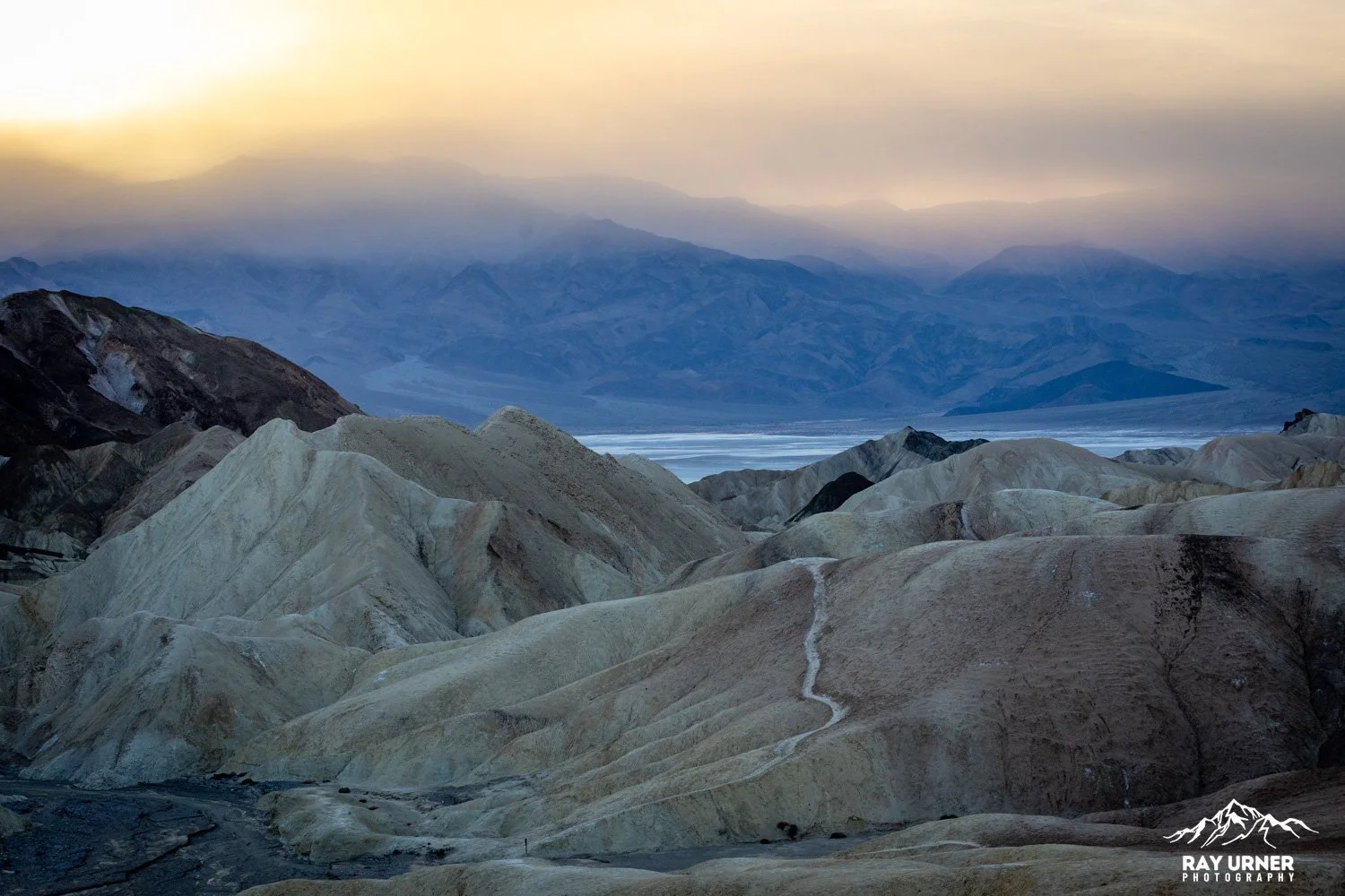
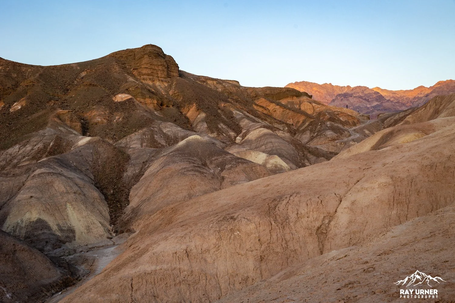
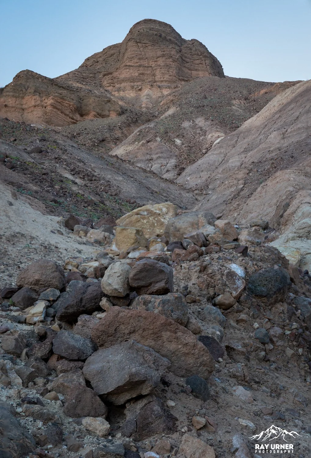
Manly Beacon — the sharp triangular peak dominating the badlands
Golden Canyon & Gower Gulch drainages (directly below)
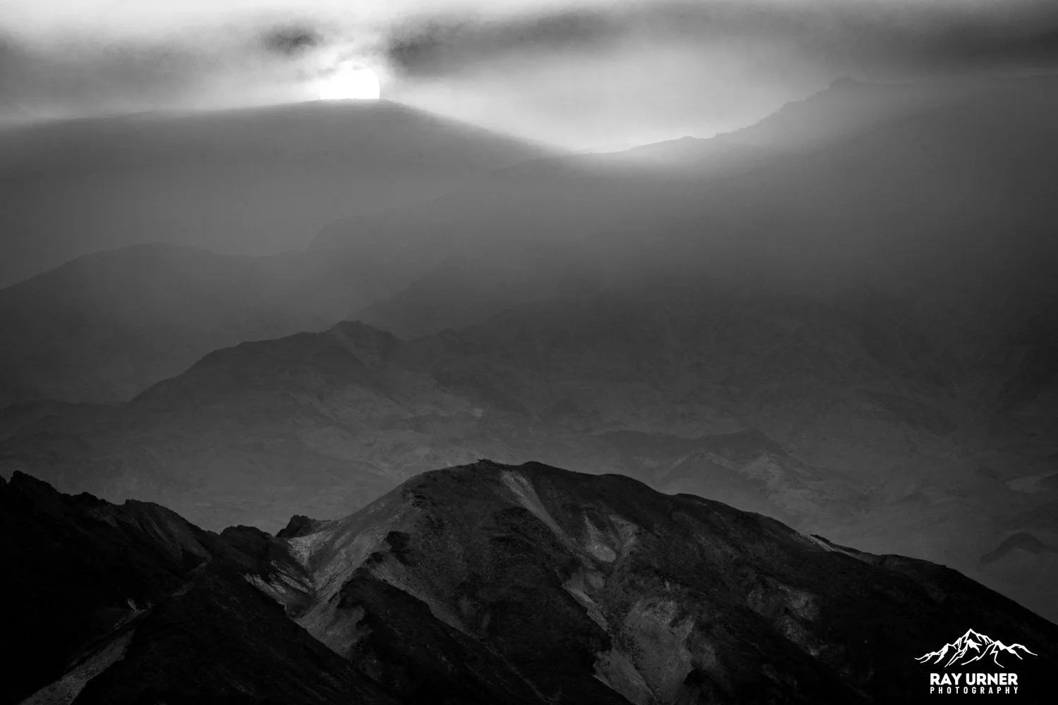
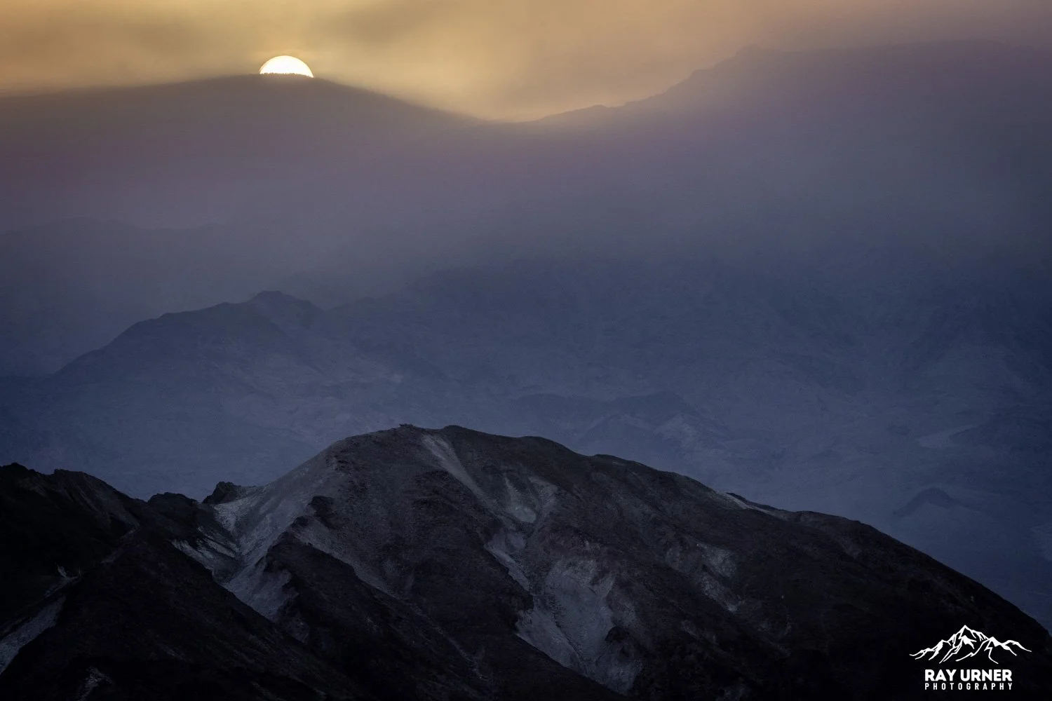
The Panamint Range glowing red and magenta at sunset
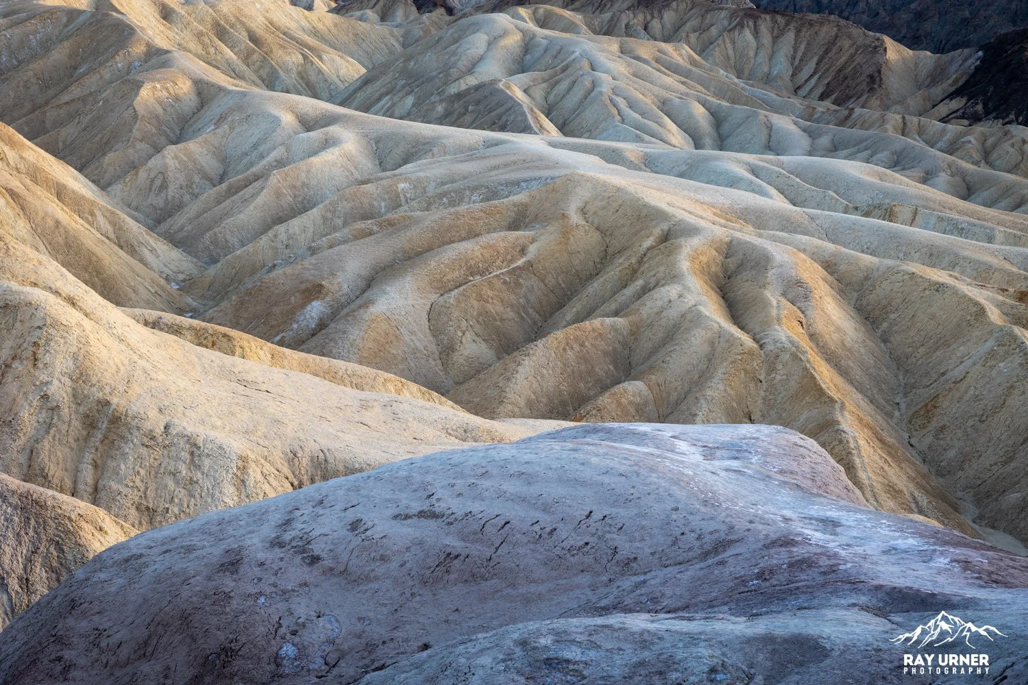
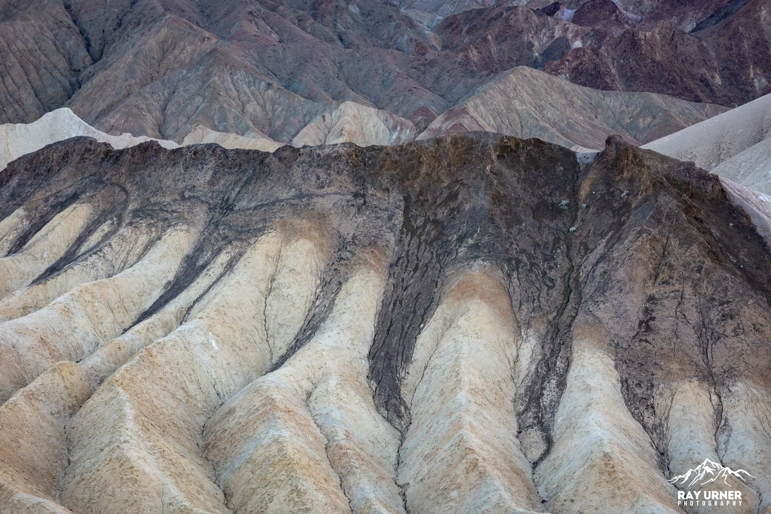
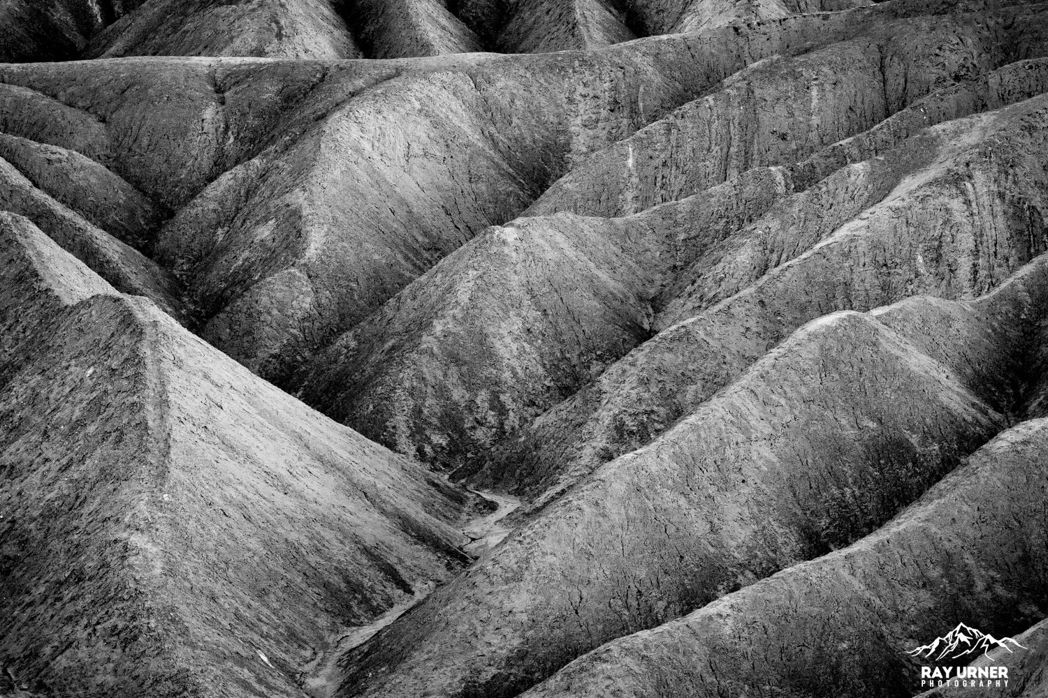
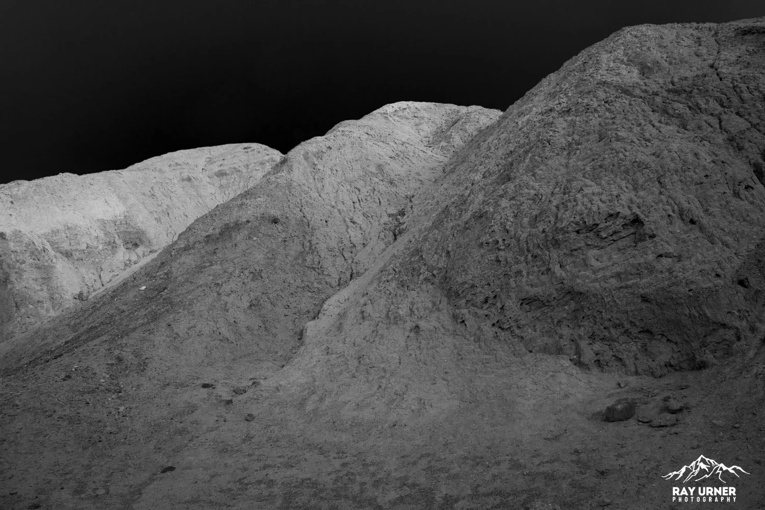
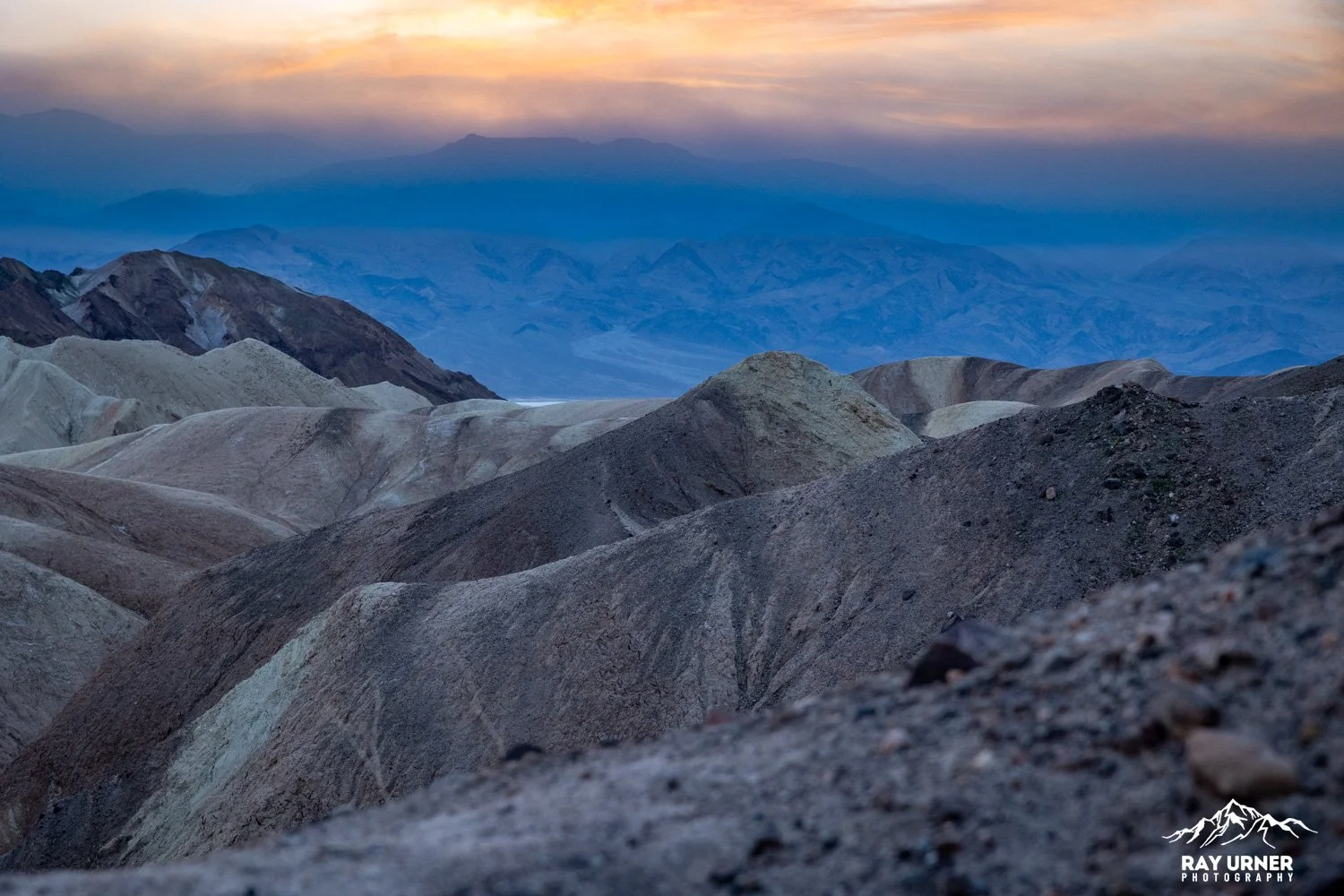
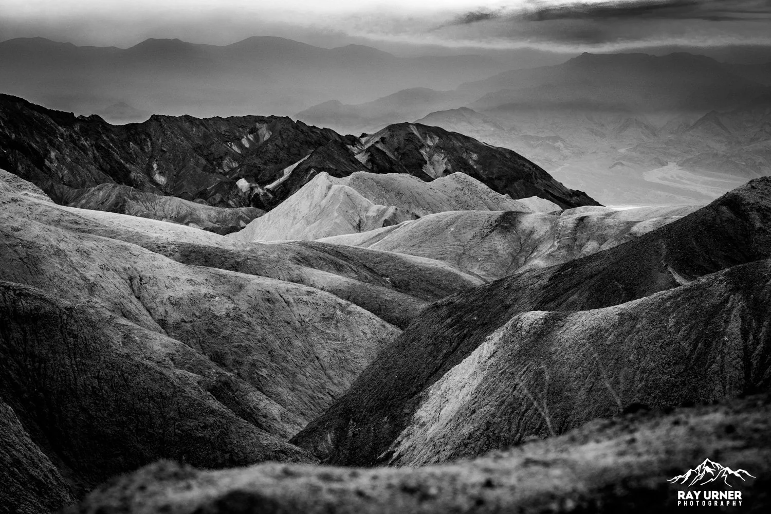
Classic undulating mudstone ridges, deeply shadowed at low angles
Zabriskie is widely regarded as one of the most photographed spots in the park and is extremely popular for both sunrise and sunset.
Sunset Light Behavior
The Panamint Range behind you (to the west) catches warm alpenglow first.
Seconds later, that warm light bounces back onto the badlands.
As the sun lowers, shadow‑to‑light transitions along the ridges become extremely pronounced.
Final post‑sunset glow often produces rich purples and reds.
Best Photo Angles at the Overlook
Classic ridge‑line sweep: Use 24–70mm to emphasize leading lines toward Manly Beacon.
Telephoto abstracts: 70–200mm isolates flowing mudstone geometry.
People‑in‑landscape silhouettes: Easy due to elevated viewpoint and open skyline.
Ultra‑wide (14–20mm): Useful to exaggerate the deep curving ridges from the fence line.

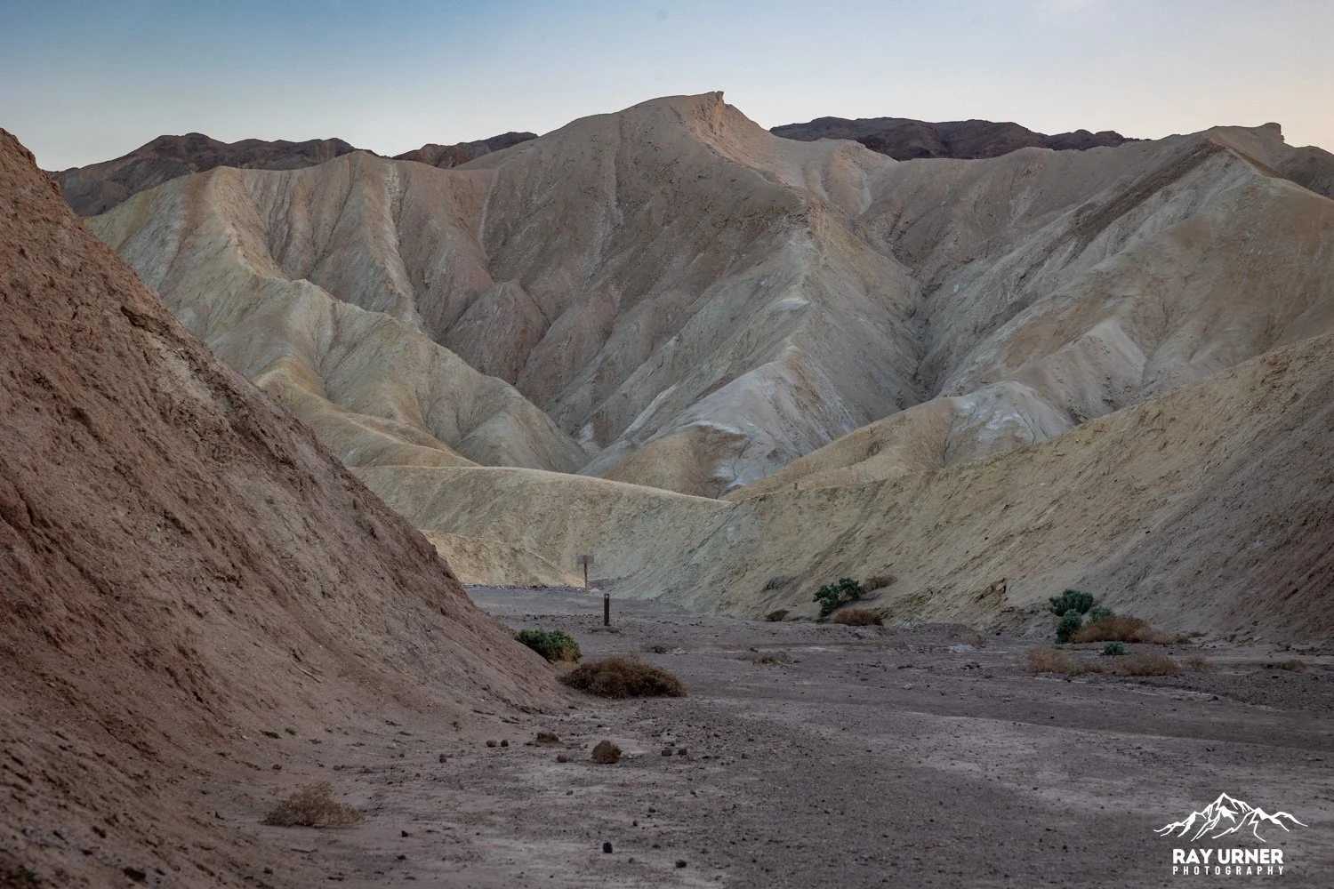
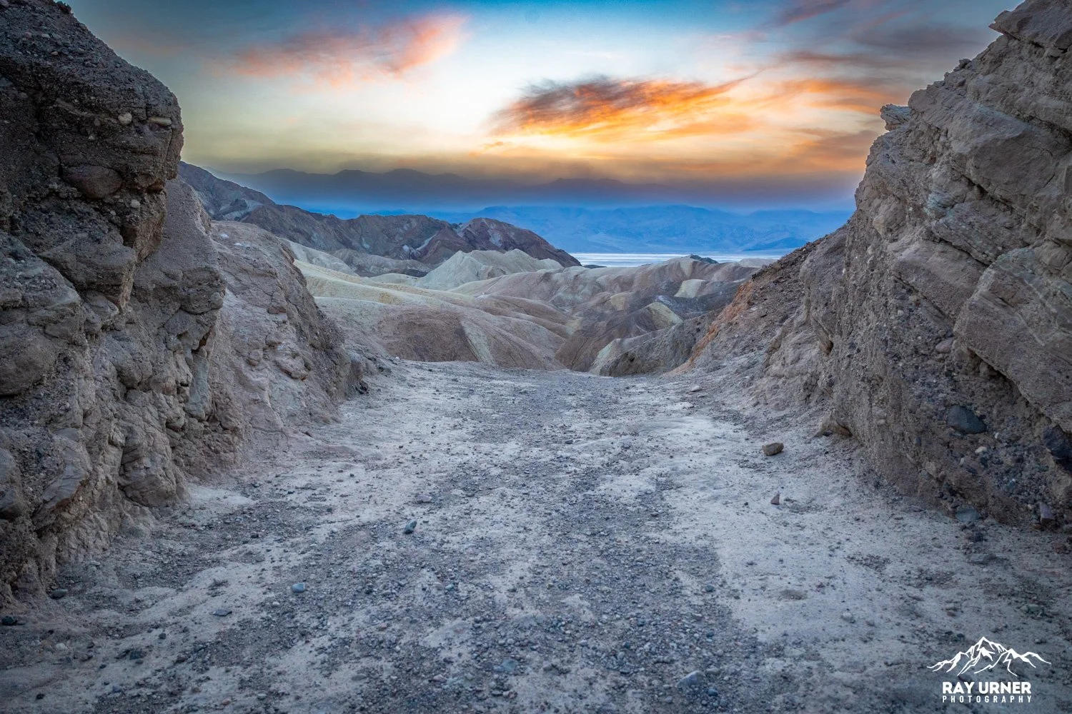
The Trail From the Overlook to the Valley Floor
(The Badlands Loop + connectors to Golden Canyon & Gower Gulch)
There are two ways down from Zabriskie Point:
(1) the Badlands Loop (full 2.7‑mile loop), and
(2) the longer through‑route toward Golden Canyon & Gower Gulch (requires shuttle), but you can sample the first section and return to the lot.
Where the Trail Begins
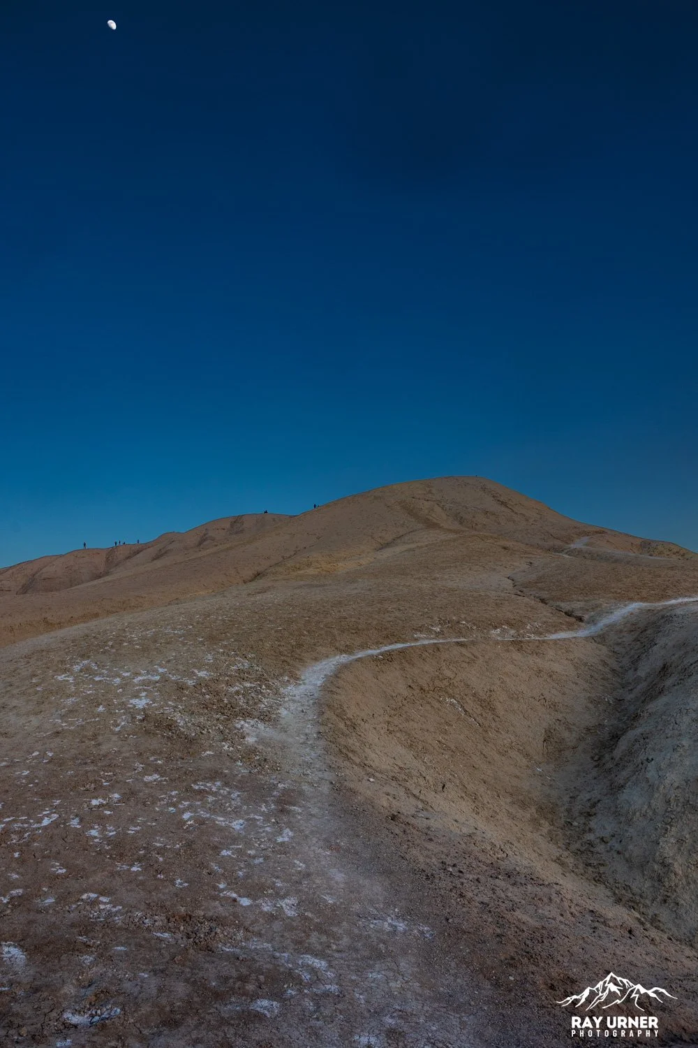
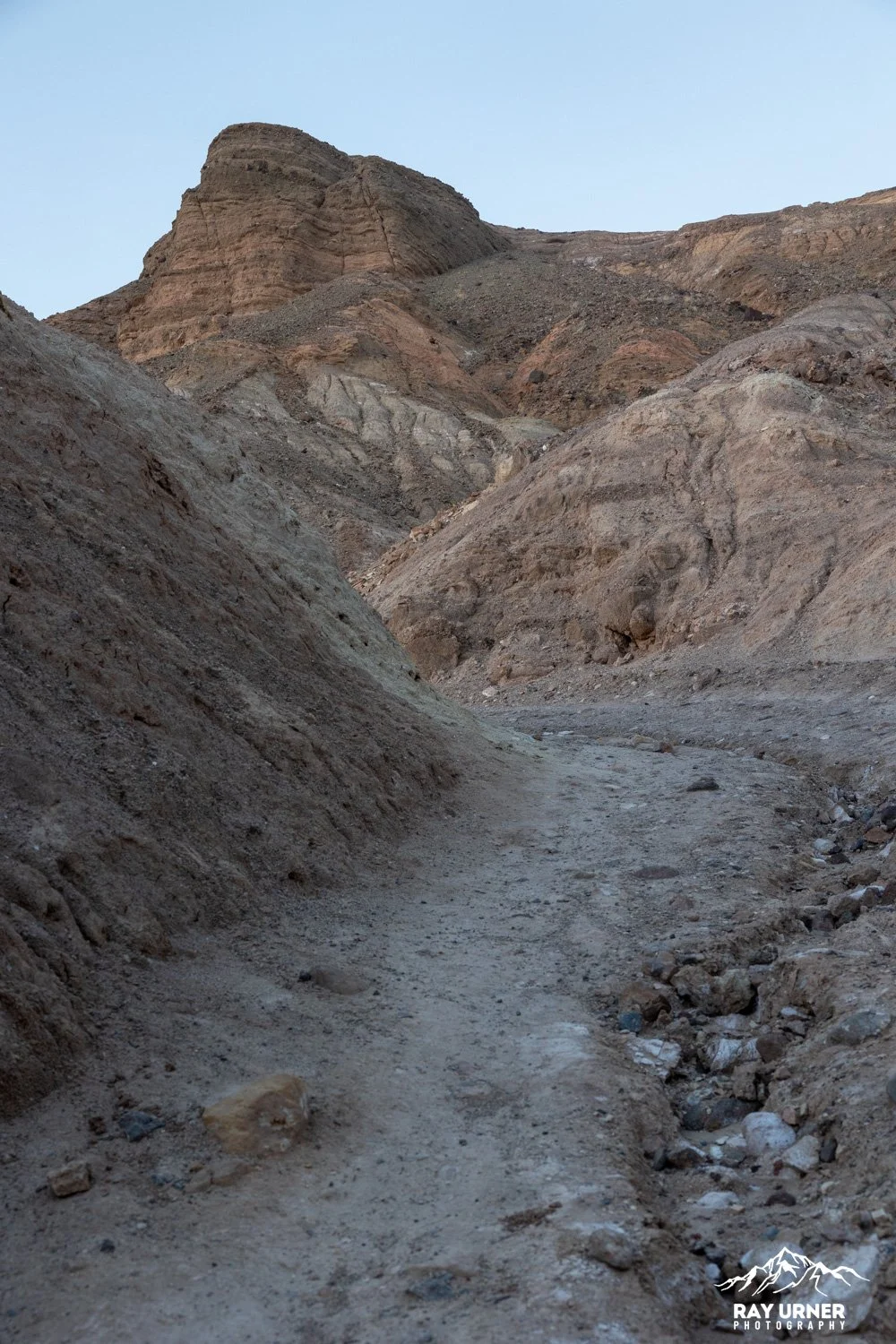
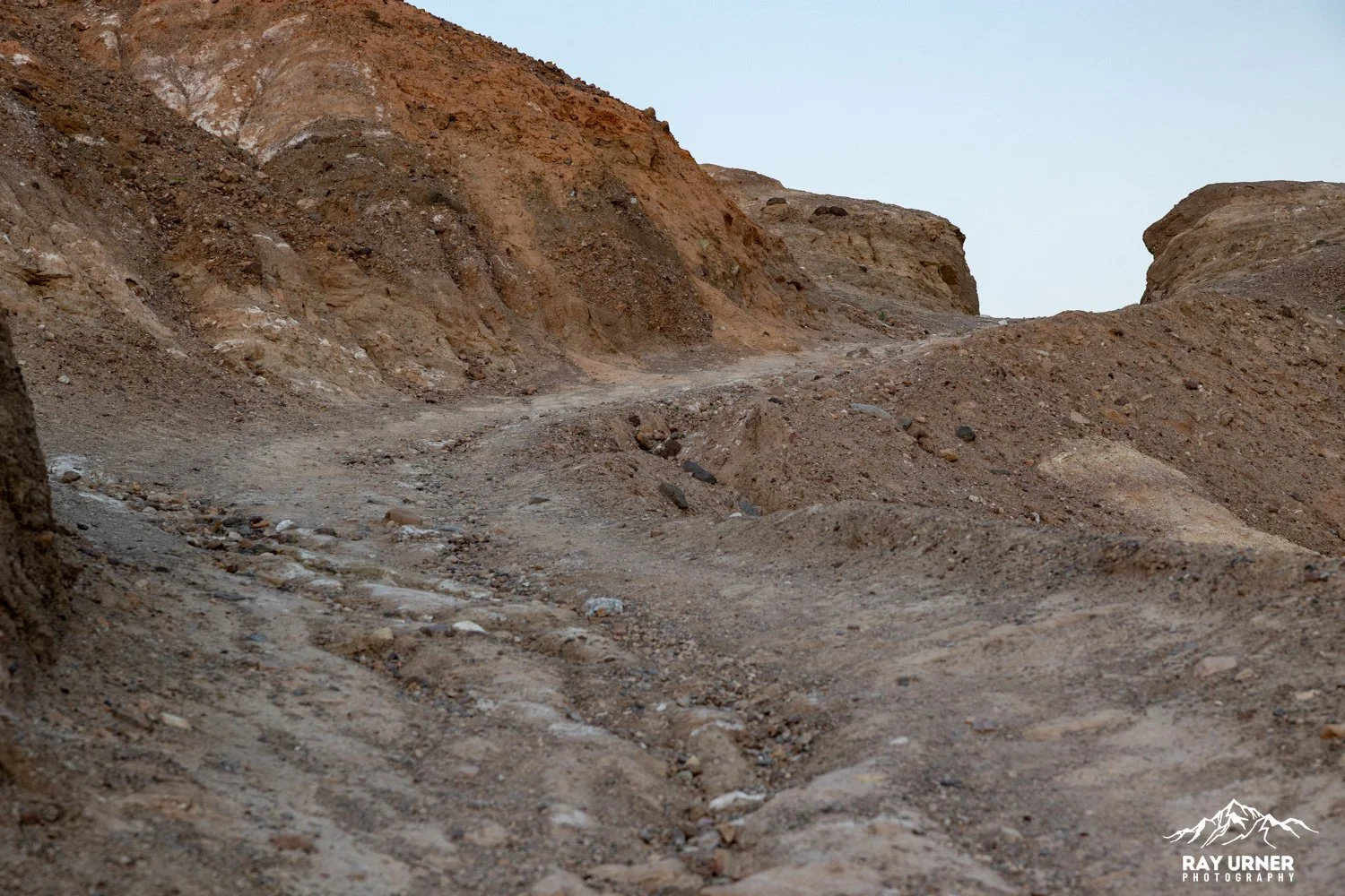
The hiking trail starts directly from the viewpoint, not the paved overlook path — it branches away from the parking area on a gravel/dirt path.
Initial Descent
From the trailhead, the route:
Immediately leaves the paved overlook path
Drops into the yellow mudhills along a well‑defined gravel trail
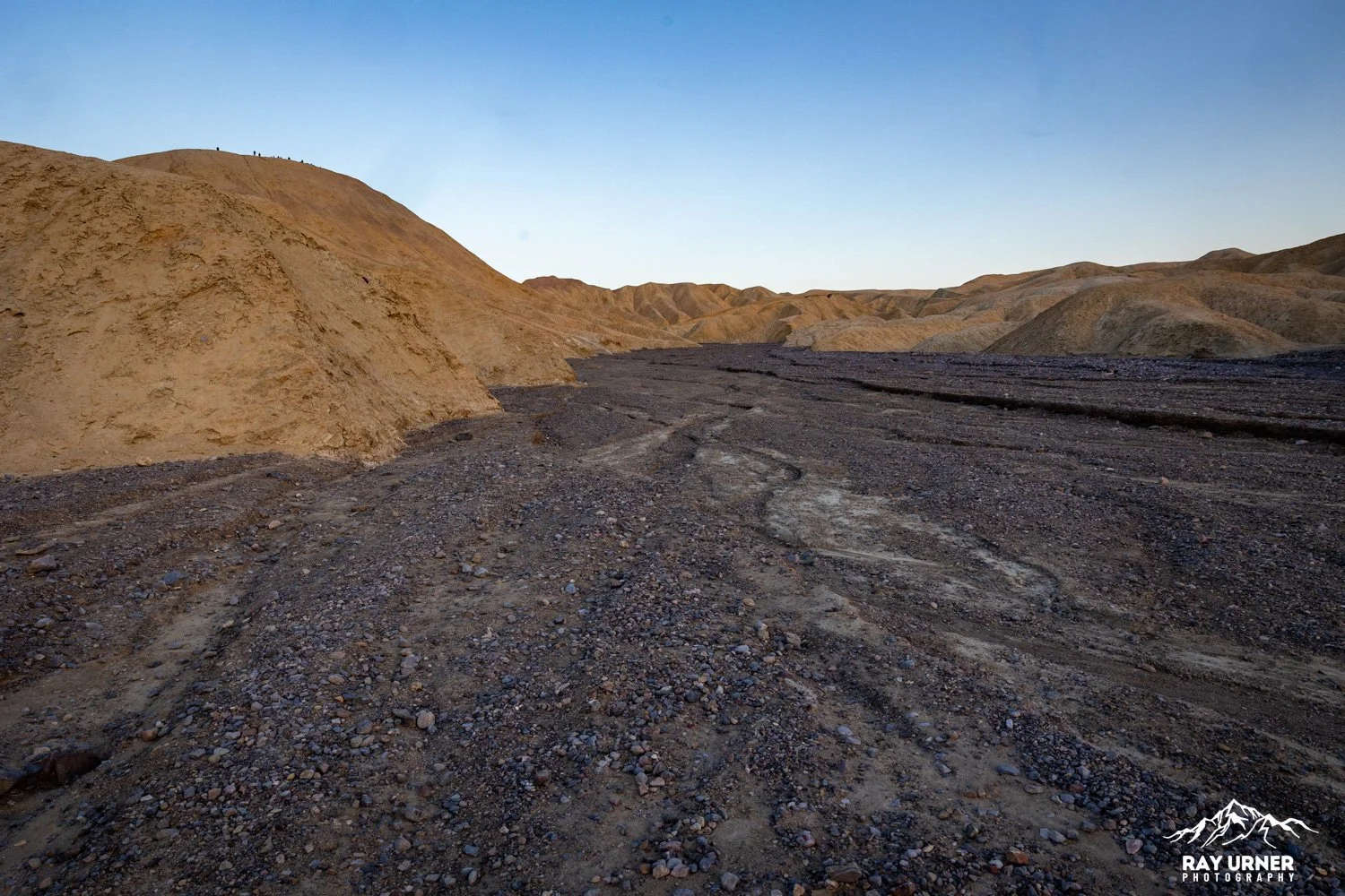
Winds through narrow, eroded badland trenches for ~0.4 miles before reaching larger drainage areas
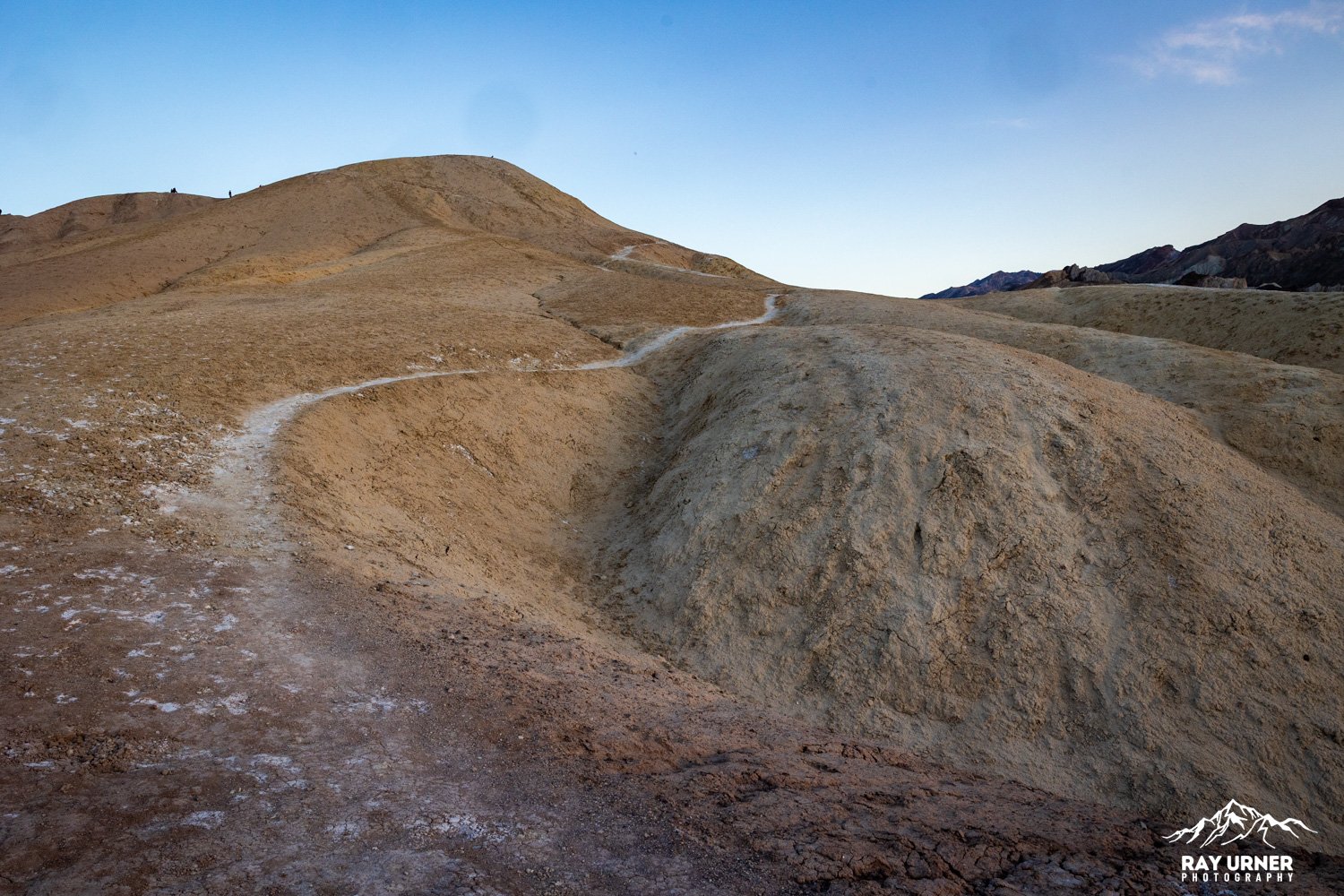
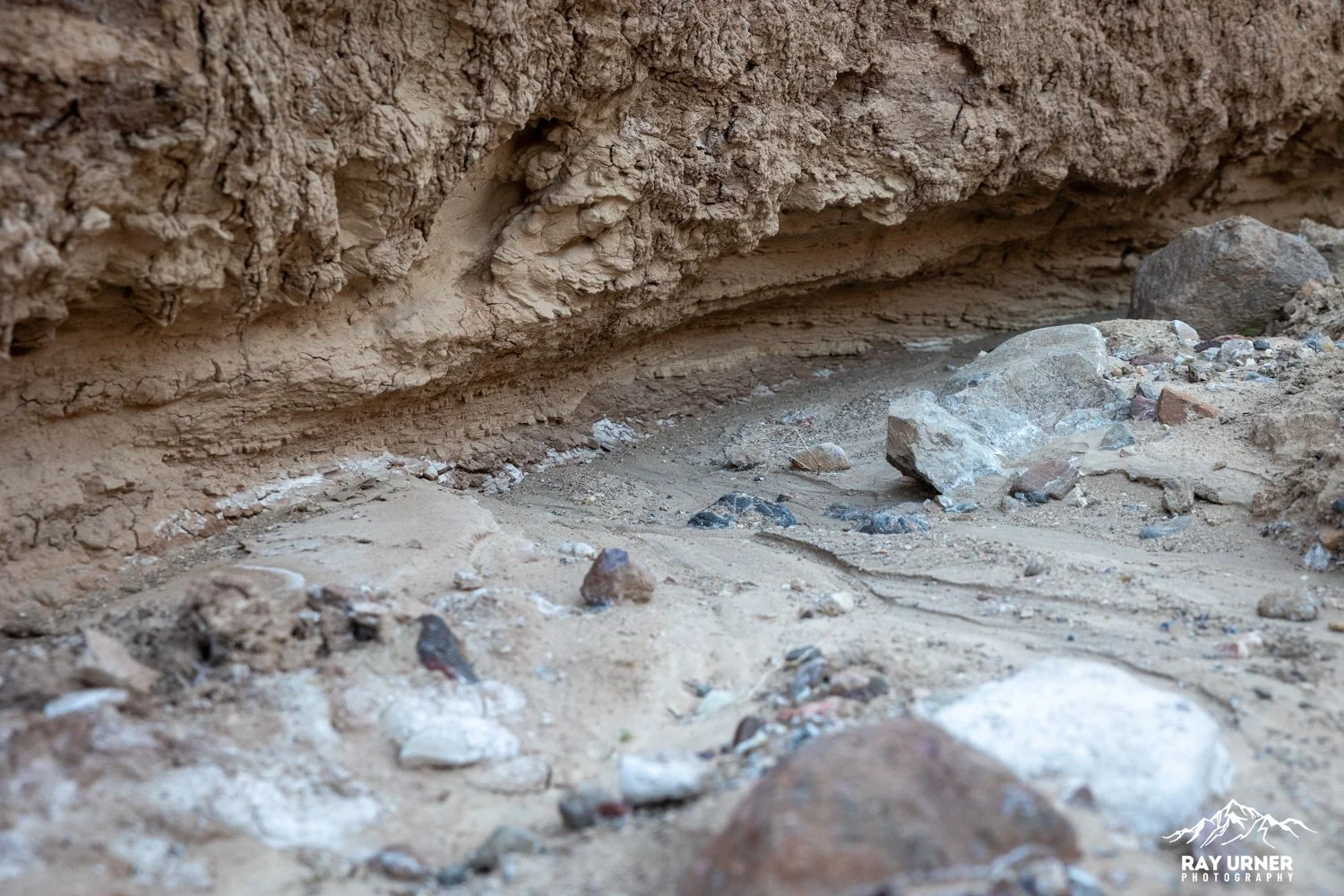
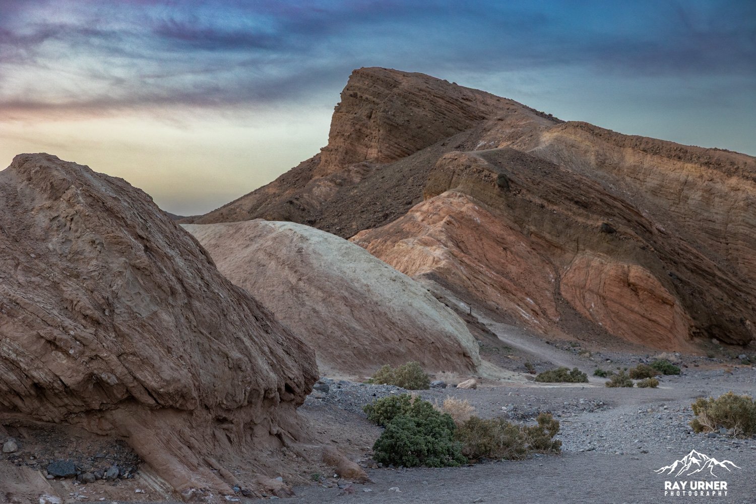
Navigating the Badlands
You’ll traverse:
A maze of narrow canyons
Low ridges carved by erosion
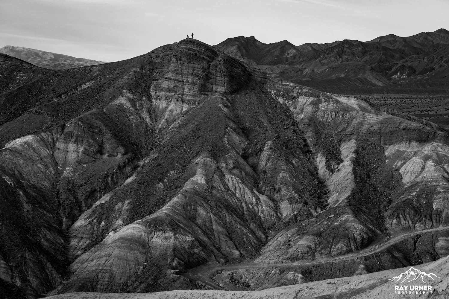
Mudhill highs and lows with stunning views back toward Manly Beacon
Trail signs mark the main intersections, but because the badlands form a labyrinth, it’s smart to study the NPS badlands map beforehand. (But honestly, you can just use the main viewpoint as your anchor, and walk right back to the parking lot)
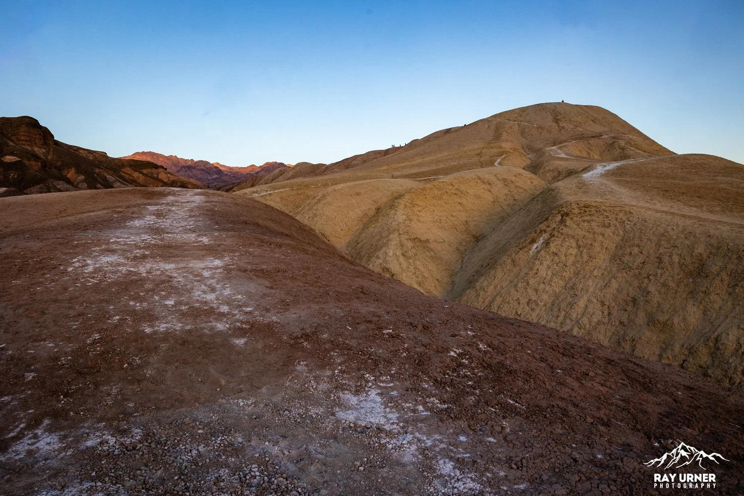
The Badlands Loop (Down + Back to the Parking Lot)
Distance: 2.7 miles
Difficulty: Easy
Time: 1.5–2 hours
Loop Description
Descend from Zabriskie into the colorful badlands
Follow the signed junctions through narrow washes and ridges
Climb gradually back toward the parking lot on the return side of the loop
This is the best option if you want to:
Photograph from inside the badlands before sunset
Explore lower terrain
Return to your vehicle without doing the full Golden Canyon circuit
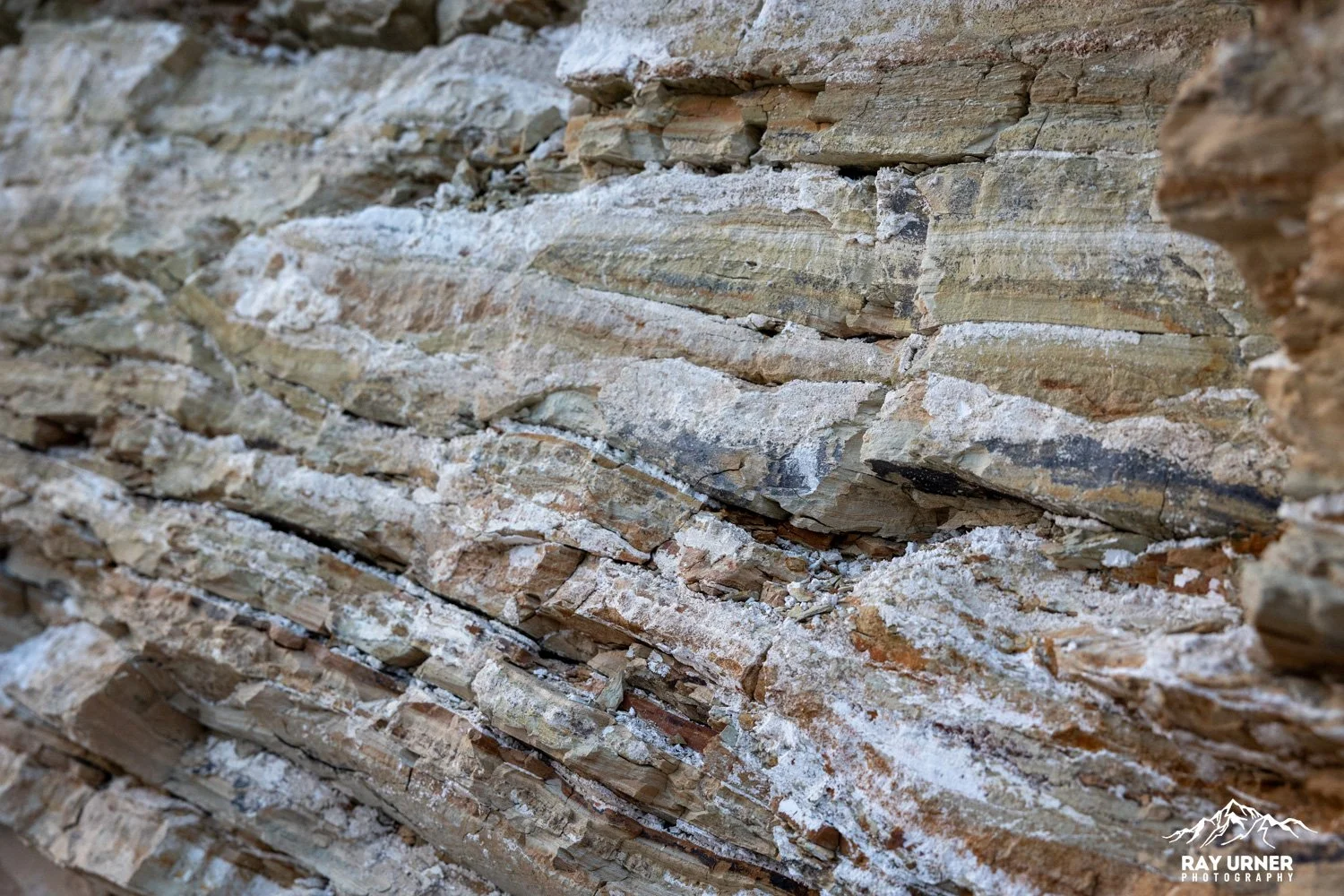
Photo Considerations Inside the Badlands
Lower elevations give reverse compositions looking back up toward Manly Beacon.
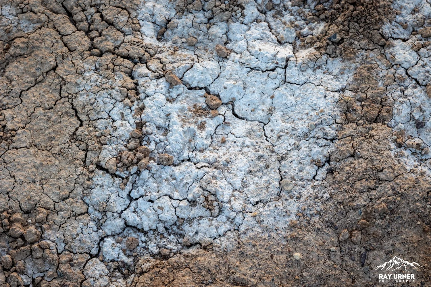
Late‑day light creates long angular ridge shadows for perfect abstract geometry.
The mudstone walls pick up warm reflected light from surrounding formations.
Safety Notes
No shade anywhere — carry water and avoid descending too close to sunset unless you have headlamps.
Avoid badlands during rain or storm forecasts due to flash‑flood risk.
Stick to signed junctions; the badlands can be confusing.
Pro Tips
For sunset, arrive 60+ minutes early — the overlook fills fast.
Shoot both toward and away from the sun — reflected alpenglow can be stronger than direct light.
If doing the Badlands Loop, consider starting 90 minutes before sunset so you end the loop near the overlook right as color peaks.
Bring a telephoto for patterns and a wide lens for the full vista.