
Hidden Valley Nature Trail
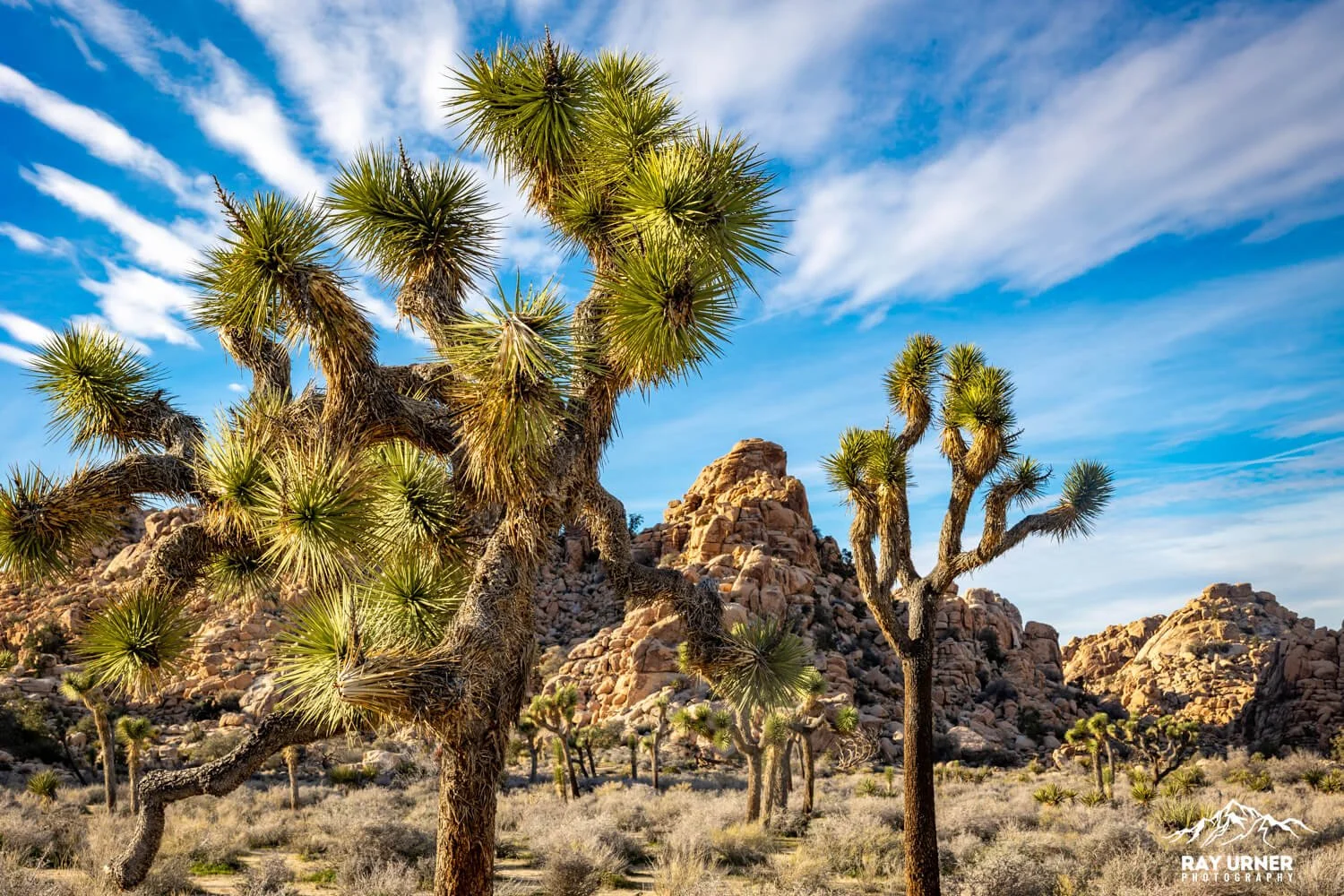
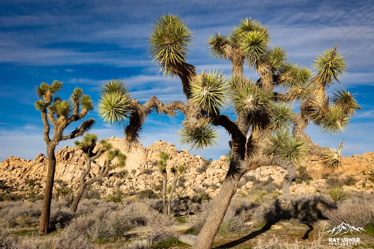
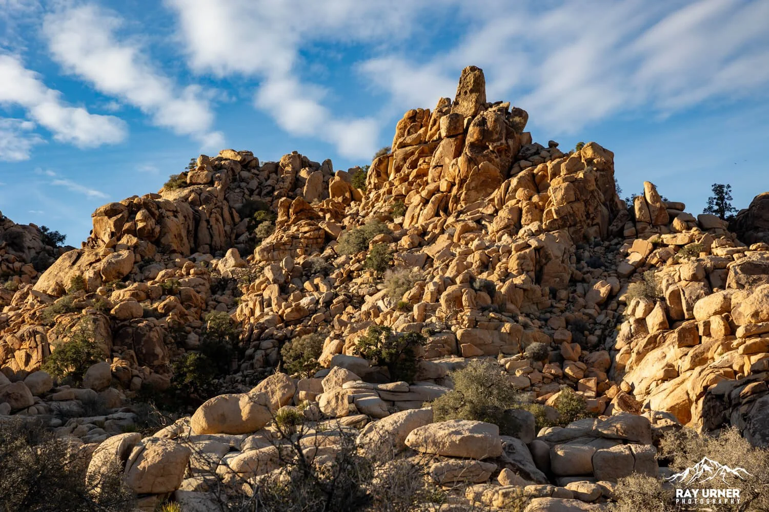
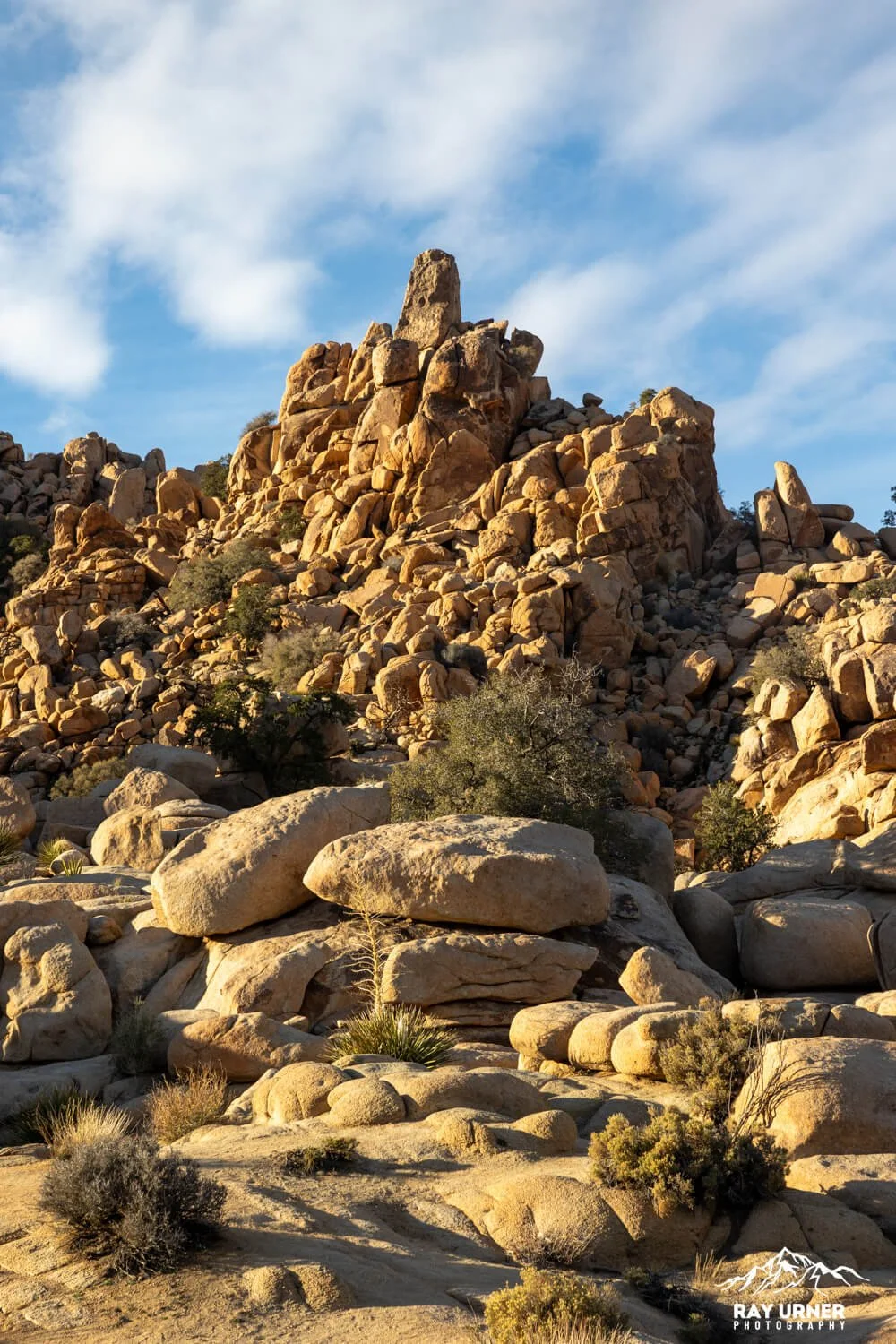
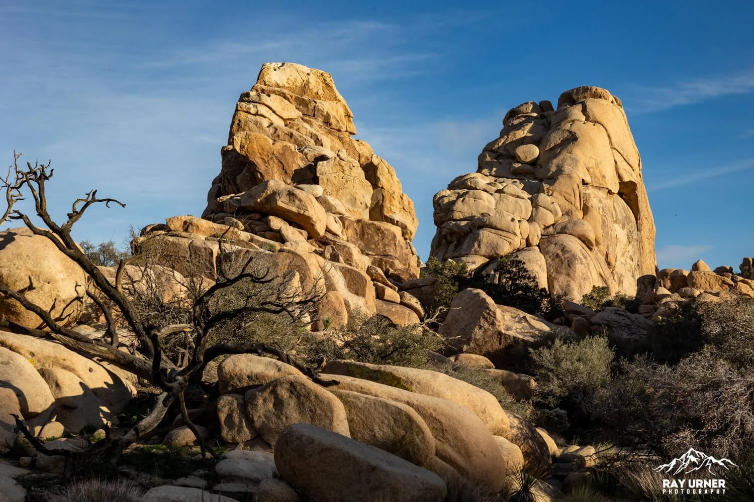
Hidden Valley is a natural amphitheater of rounded monzogranite boulders and classic Mojave flora. The loop delivers constant foreground–midground–background options: yucca and Joshua trees against rust‑colored rock, with clean desert sky for negative space. It’s also a climber magnet, so you can add human scale to your frames without staging a thing.
Hidden Valley Nature Trail — Photography & Hiking Guide
Short, scenic, and wildly photogenic—Hidden Valley packs “classic Joshua Tree” into a one‑mile loop with boulder stacks, twisty Joshua trees, and a pinch of Old West lore. Perfect for a first stop or a golden‑hour encore.
Quick Facts
Distance & Gain: 1.0 mile loop; ~100 ft gain (easy)
Time on Site: 30–60 minutes (longer if you scramble or shoot)
Trail Character: Hard‑pack sand, gravel, rock steps, a few narrow passages; little shade; no reliable cell service
Facilities: Large day‑use parking, vault toilets at the picnic area/trailhead; popular and fills early on busy days
Best Seasons: Fall–spring; summer heat regularly exceeds 100°F
History
Local legend says cattle rustlers once funneled stolen stock into this rock‑walled pocket to… keep things “hidden.” Desert rancher Bill Keys reportedly blasted an opening in the 1930s to bring his own cattle into the valley—today it’s the notch you walk through at the start of the trail.
Indigenous context: This broader landscape sits within the homelands of the Serrano, Cahuilla, Chemehuevi, and Mojave peoples; while specific habitation inside the walled valley is less documented, the region’s resources and rock shelters were used for millennia. (For visitors: tread lightly and leave cultural features undisturbed.)
Geology
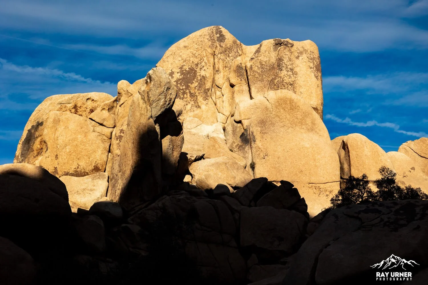
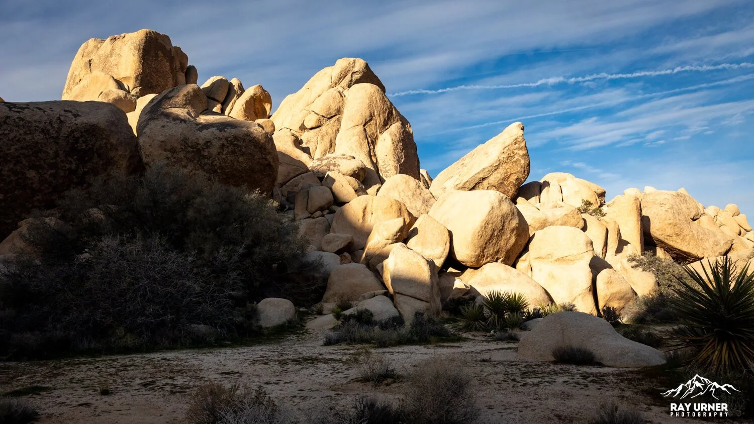
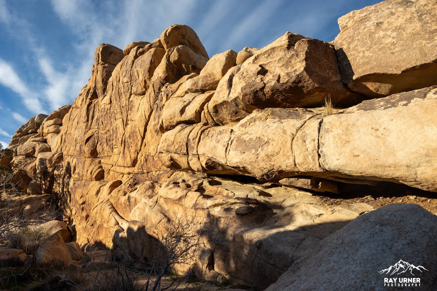
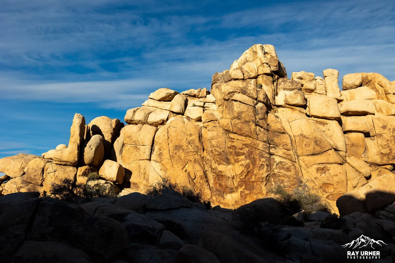
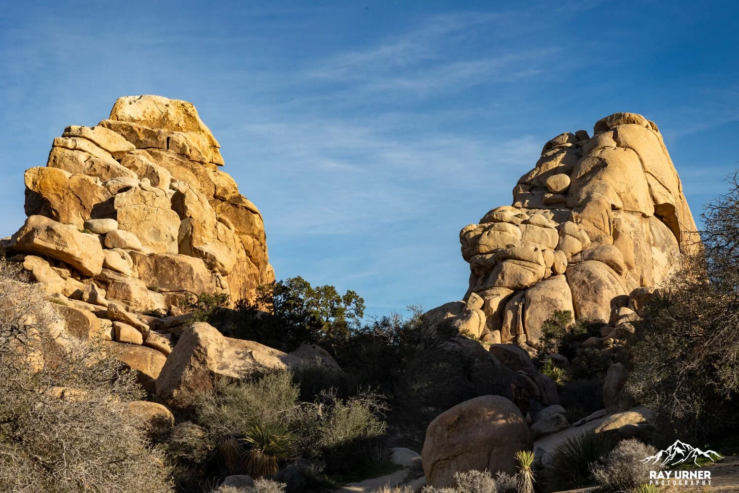
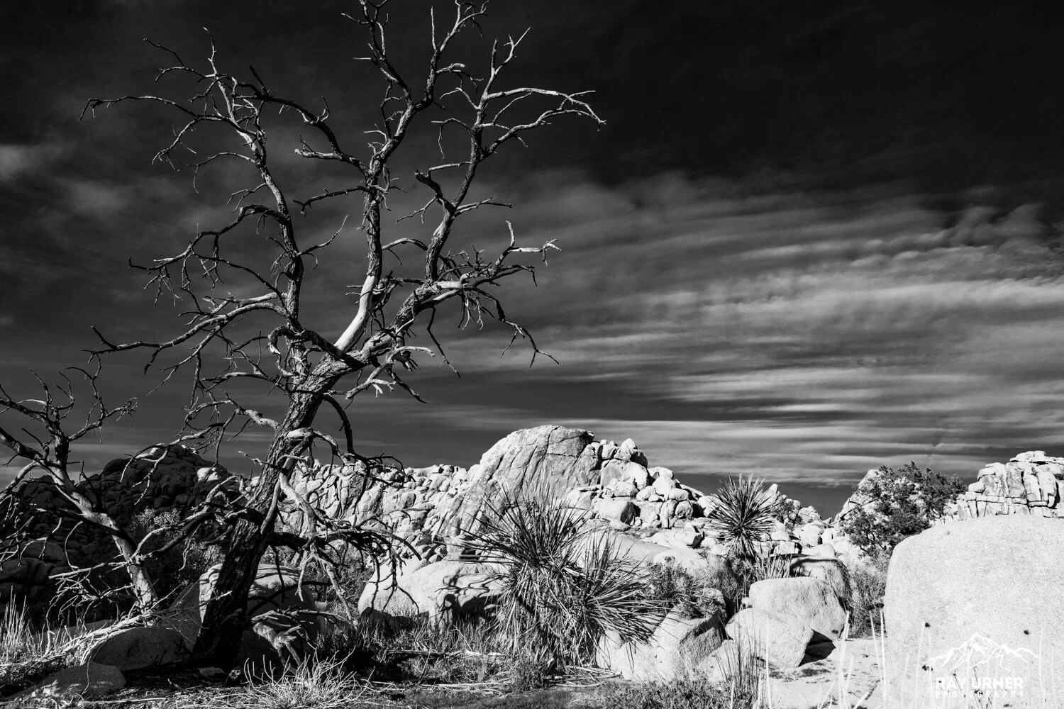
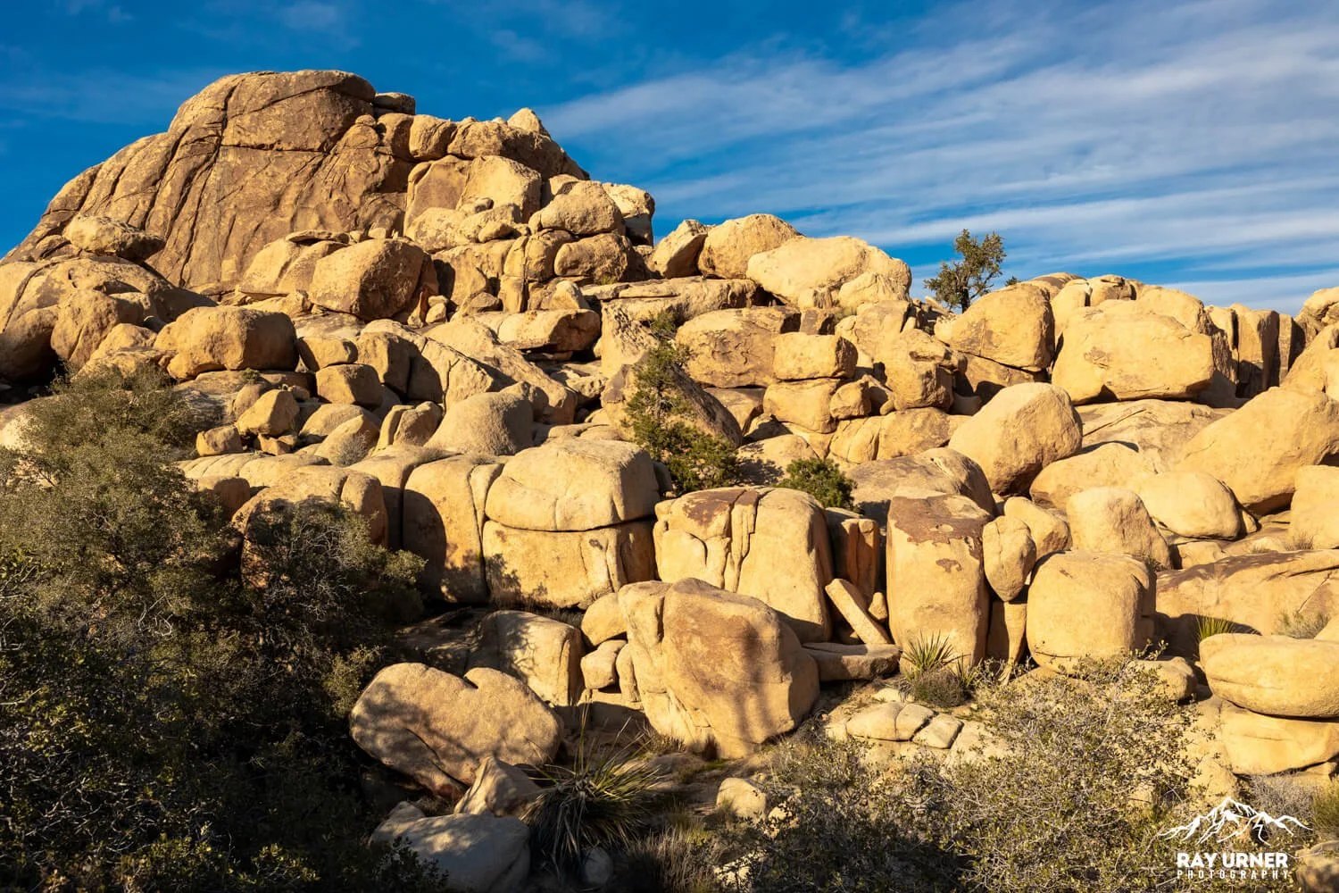
Hidden Valley’s iconic rock piles began as plutonic intrusions—granitic monzogranite that cooled underground >100 million years ago. Networks of joints formed as the rock uplifted and overburden eroded away. Groundwater then weathered the blocks from sharp‑edged rectangles into rounded “spheres” (classic spheroidal weathering). Once the climate dried, flash floods scoured away the softened matrix, leaving today’s stacks and corridors. Watch for light‑colored pegmatite/aplite dikes crisscrossing the walls.
Ecology
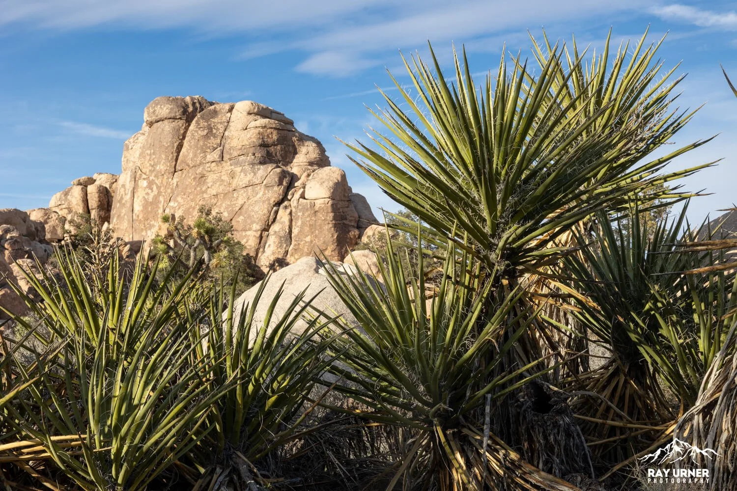
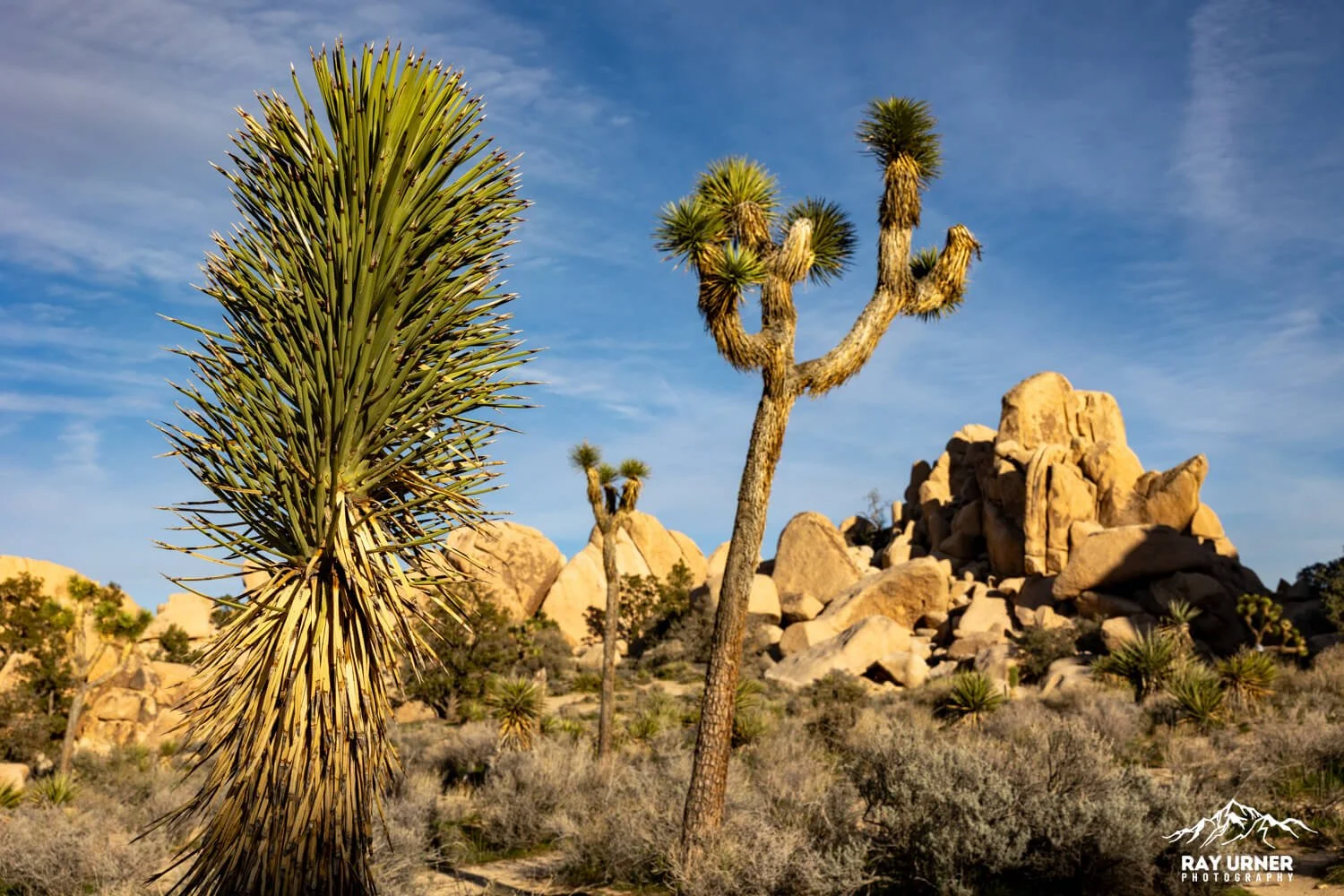
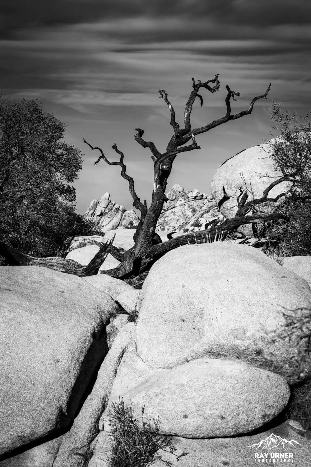
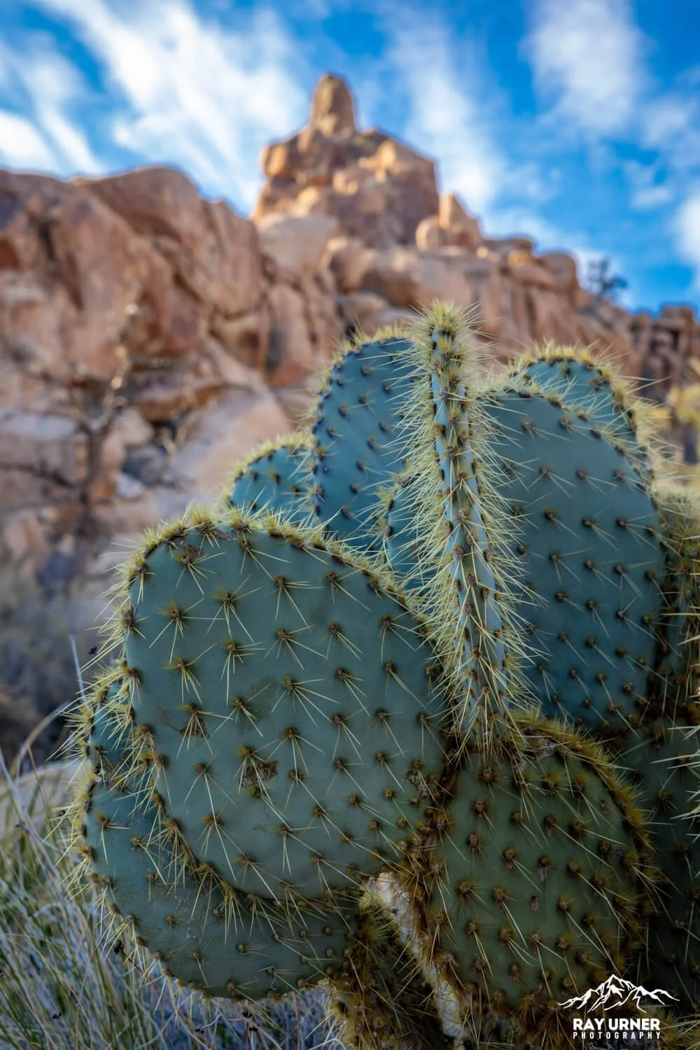
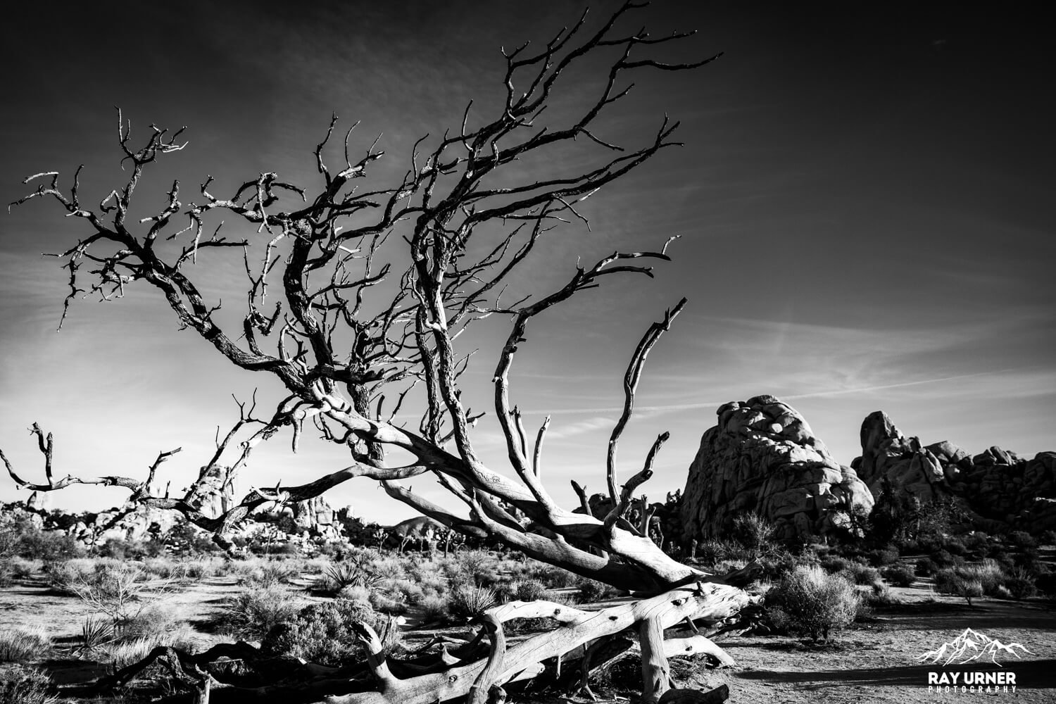
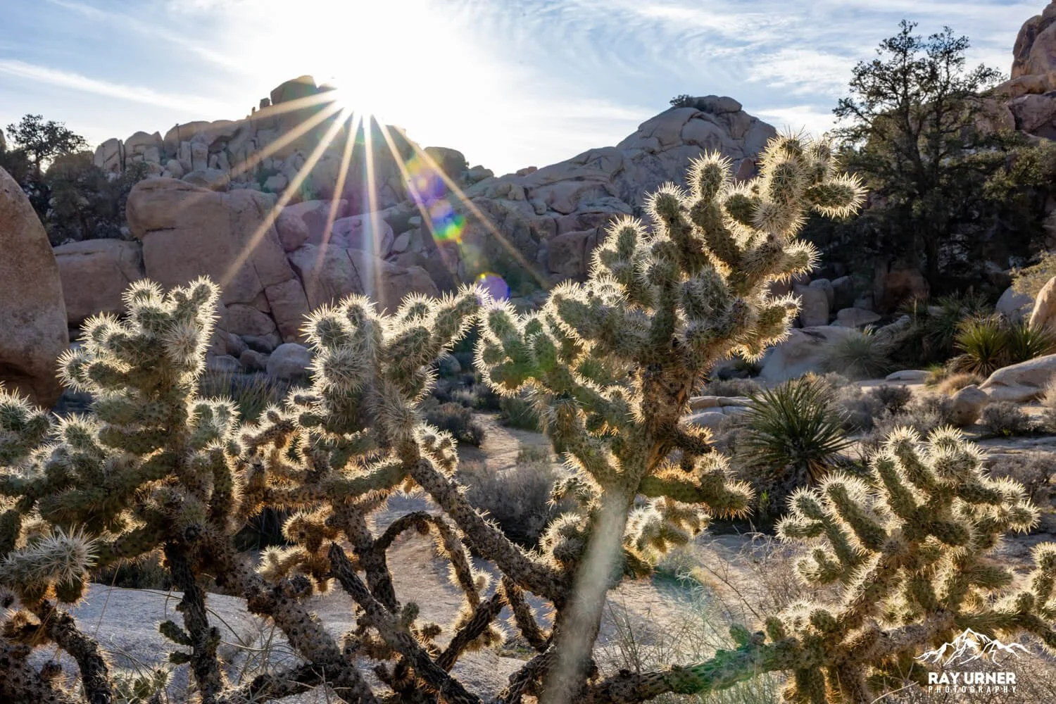
Hidden Valley’s rock walls create a sheltered, slightly cooler micro‑habitat. Expect Joshua trees (Yucca brevifolia), Mojave yucca, and—where shade and runoff collect—pinyon and juniper pockets, plus desert scrub and seasonal wildflowers. Lizards use crack “loopholes,” and rock wrens haunt the talus. Interpretive signs along the loop highlight plant and wildlife adaptations.
Best Photo Spots (and how to shoot them)
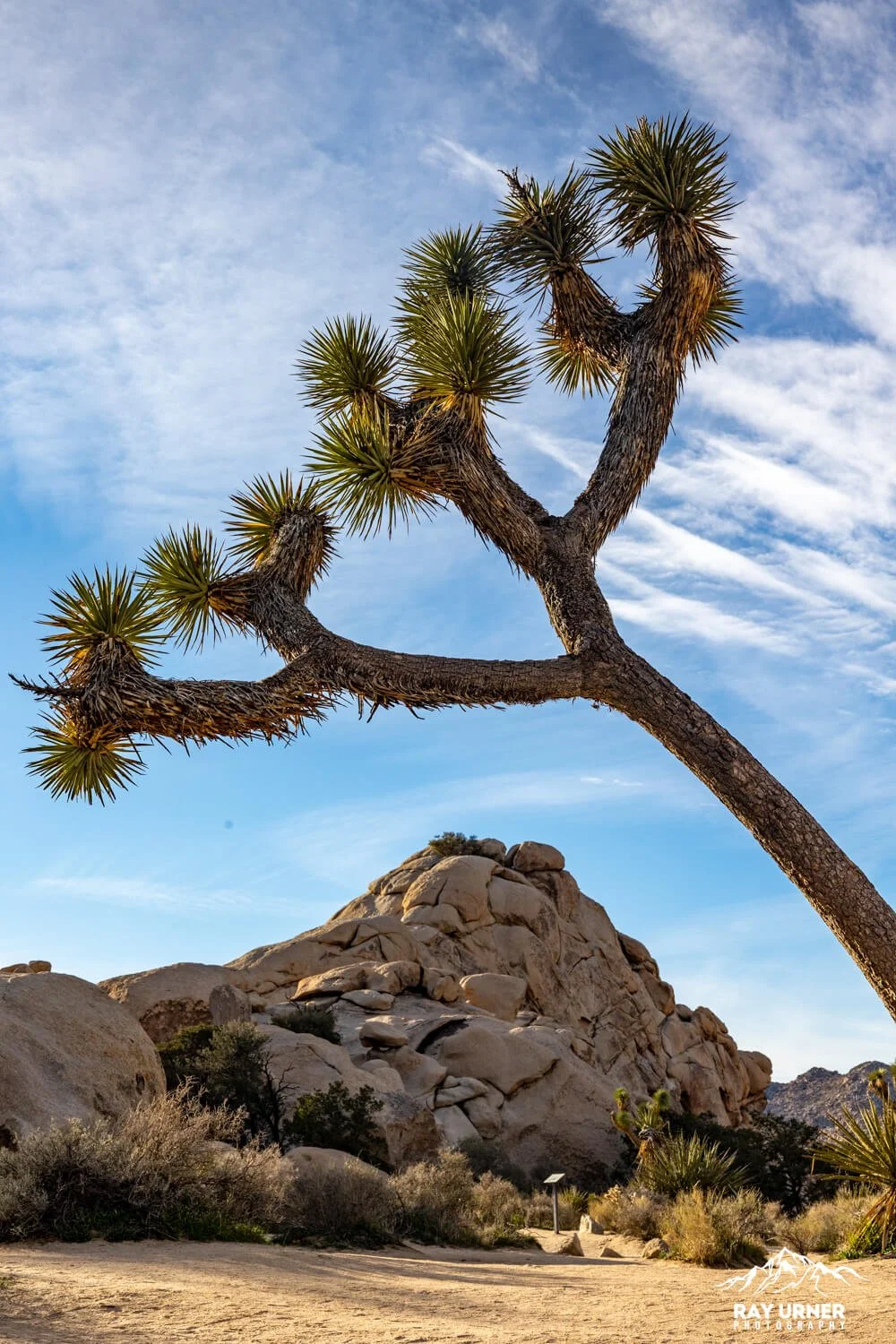
The Entrance Notch
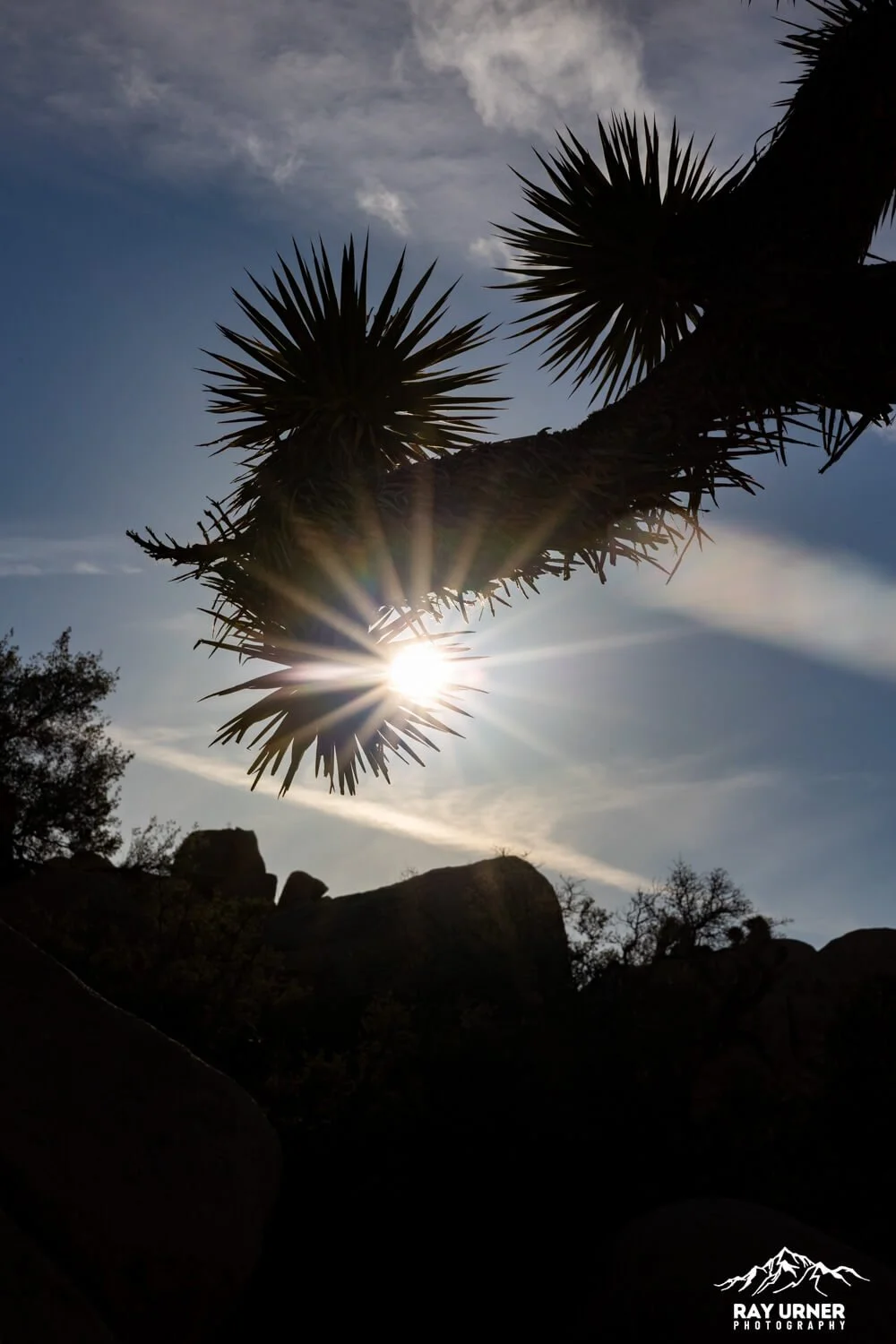
Frame hikers or a lone Joshua tree through the blasted gap for a natural proscenium. Early light rakes across the boulder textures; late light gives warm side‑glow. Ultra‑wide (14–24mm) for the full portal; 35–50mm for people‑scale portraits.Inner Valley Meadow
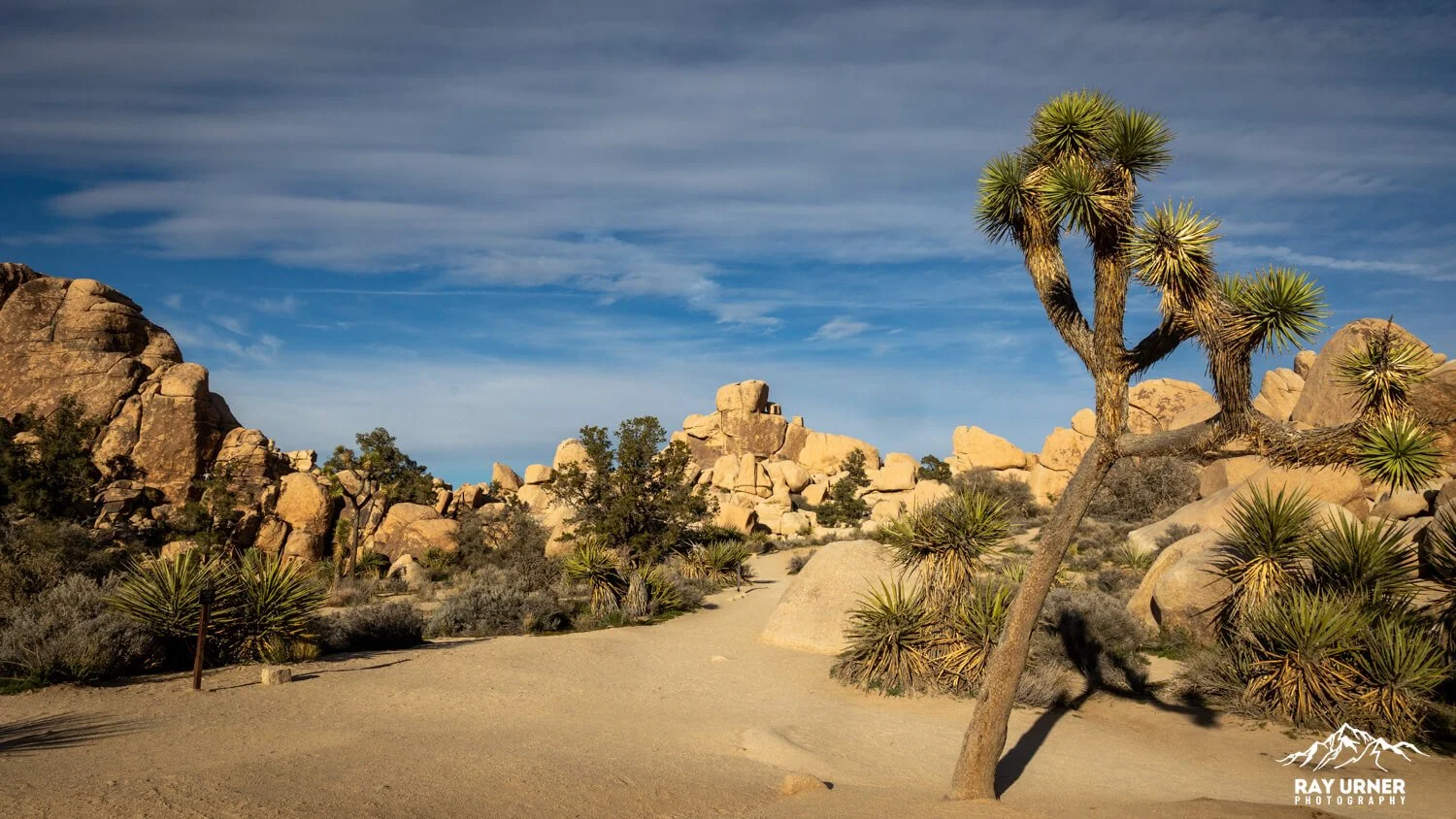
About a third of the way in, the view opens to a sandy floor with encircling rock stacks. Place a Joshua tree off‑thirds; use low angles to elongate limbs against sky. 24–70mm is the workhorse here.Boulder Corridors
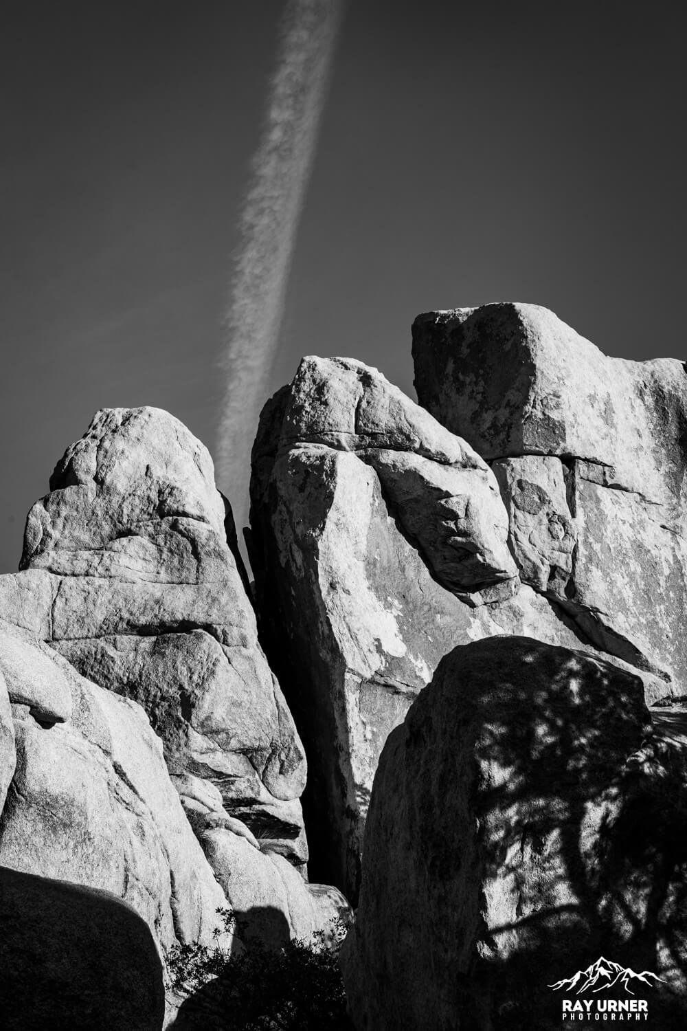
Use narrow rock alleys for leading lines; look for a dog‑shaped formation on the wall above the valley for a fun telephoto detail. 70–200mm compresses layers and isolates forms.
Shot List
Signature Wide: Low‑angle Joshua tree + enclosing boulders at sunrise or late afternoon.
Texture Study: Side‑lit monzogranite with dike lines; stop to f/11–f/16 for crisp edges.
Compression Layers: Telephoto stack of boulder tiers for abstract geometry.
Blue‑Hour Silhouette: Joshua tree form against cobalt sky; tripod, ISO 100–400, 1–4s.
Lens & Filter Baseline: Ultra‑wide (14–24/15–35), mid‑zoom (24–70), tele (70–200), Circular polarizer; add an ND filter if you want motion blur in wind‑bent branches.
Light & Timing
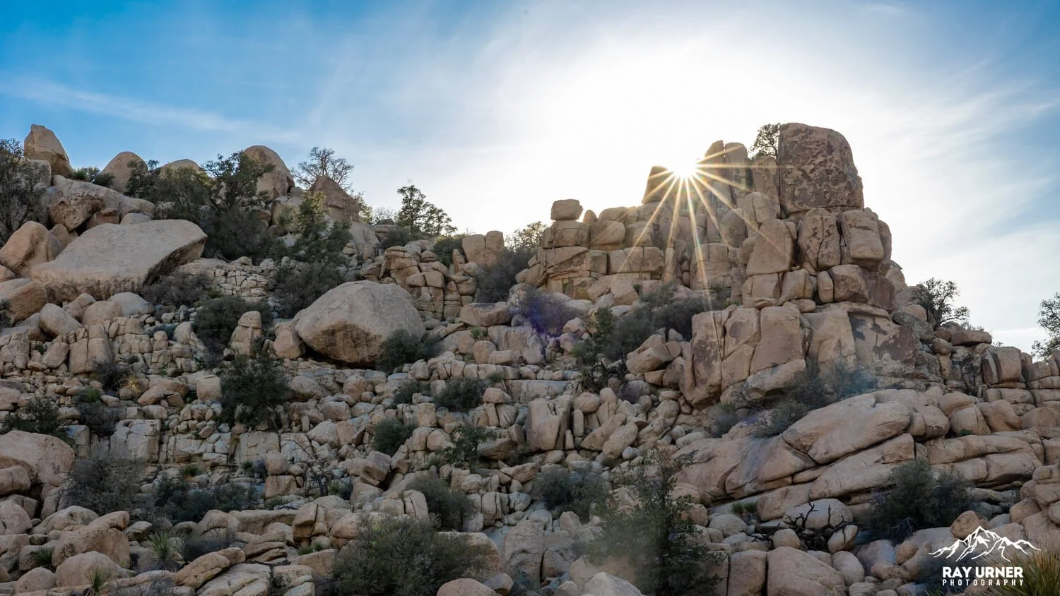
Sunrise: Soft cross‑light accentuates boulder contours; fewer people (the best part!) & cooler temps.
Late Afternoon → Sunset: Warm hues on rock; watch for long tree shadows and peachy sky gradients.
Mid‑day: Harsh for landscapes but ideal for action shots of climbers on nearby crags.
Hiking Intel
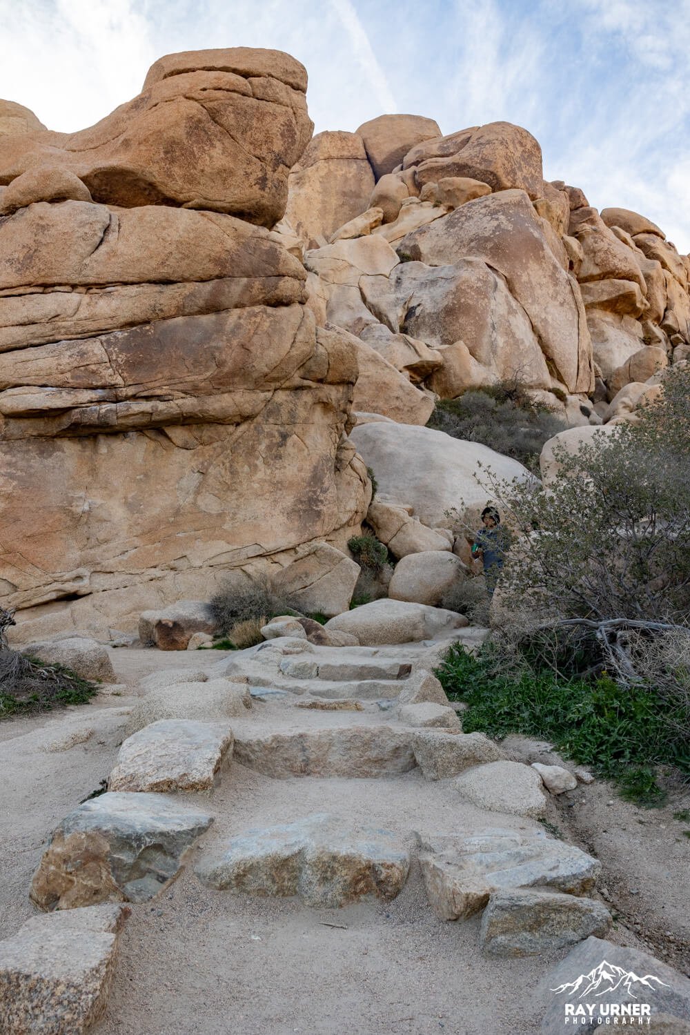
The loop starts with short rock steps through the entrance notch, then meanders on sand and hard‑pack with occasional stone steps. It’s well signed (interpretive panels along the way) and family‑friendly, but crowds and parking pressure spike on weekends/holidays—arrive early. Shade is limited; there’s typically no cell service.
Seasonal note: Summer heat often exceeds 100°F; carry ample water and avoid peak‑heat hours.
Pro Tips
Beat the rush: Start by 9:00 a.m. on busy days; earlier is better for parking and clean frames.
Wind strategy: Use boulders as wind breaks; bump ISO to keep branches sharp in gusts.
Alternate plan: If the lot is slammed, pivot to nearby Barker Dam or Cap Rock and circle back later.